Synopsis:
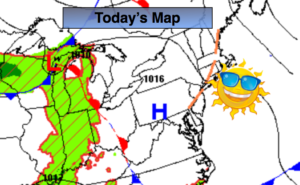
High pressure will continue to sit between the Mid-Atlantic coast and Bermuda this will result in very warm and humid conditions through Saturday.
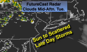
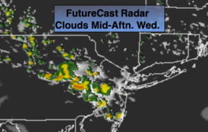
A weak disturbance will move through the region today. Areas to the South and West of the City will have a better chance of seeing more clouds and possibly a few showers this morning. The same area will experience scattered thunderstorms later today. North and East of the City will be storm-free and the sun will dominate.
The 4th of July will be hazy, warm and humid. The chance of a stray storm is very low.
The next threat of scattered afternoon storms will be Friday and Saturday. By no means will it be a washout. Saturday will be the most uncomfortable out of the bunch.
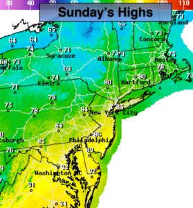
By Sunday, a refreshing airmass will move in from New England behind the passage of a cool front. The humidity will be dramatically lower. Definitely the more comfortable day of the weekend.
Stay tuned.
Keep it here for a no nonsense, no hype forecast.
Today:.
Sun and clouds. Very warm and humid. A few spotty showers possible over Western areas in the morning. Spotty storms are likely during the afternoon mainly South and West of the City. Highs in the mid to upper 80s. North to East winds at 5mph.
Tonight:
Scattered evening storms to the South and West of the City, otherwise partly cloudy and muggy. Lows in the lower 70s in the City, the 60s inland. Southeast to East winds under 5mph.
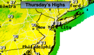
4th of July:.
Hazy, very warm and humid. Highs in the upper 80s.
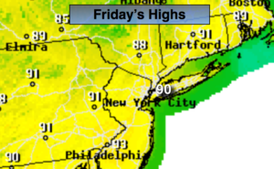
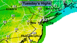
Friday:
Hazy, very warm and humid. A spotty PM Storm is possible. Highs in the upper 80s.
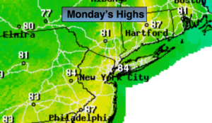
Saturday:
Hazy, hot and humid. Scattered afternoon storms. Highs around 90º.
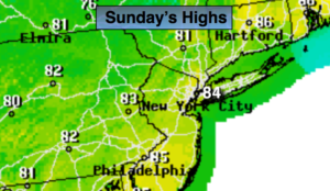
Sunday:
Mostly sunny, not as hot or humid. Highs in the mid 80s.