Synopsis:.
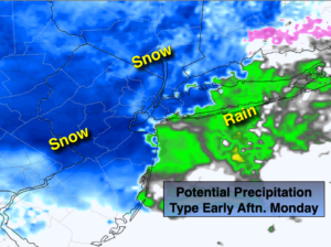
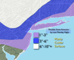
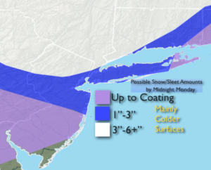
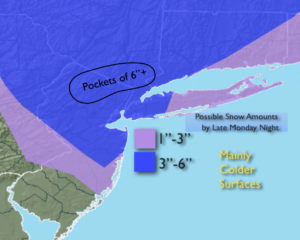
Periods of snow, some of it heavy at times in banding. The upper level low supplying the energy along with the surface storm just south of Long Island is responsible for the snow. The heaviest snowfall rates will in the New York City vicinity. The snow will lighten up at times. Areas East of the City will take some time in getting into the snow. But here too, some accumulation is likely. Parts of Eastern Long Island as well as South Coastal and parts of central NJ will receive only minor accumulations. Potential snow amounts by late tonight are posted above. Nowcasting with radar will be key in how much snow falls in your area.
Morning snow showers over Eastern areas will give way to sunshine behind the storm on Tuesday.
More tranquil conditions are expected for the rest of the week. Readings will be below the average high of 48º as a chilly Northwest wind prevails.
Stay Tuned.
Keep it here for a no hype, no nonsense forecast.
Tonight:
Periods of snow of varying intensity into Tonight. There will be burst of heavy snow especially near the NYC vicinity. Lows around 30º in the City, the 20s inland. Northwest winds at 10-20mph with gusts to 30mph at the coast.
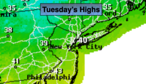
Tuesday:
Early morning snow showers East, otherwise partly sunny, breezy and cool. Highs around 40º. Northwest winds at 15-25mph.
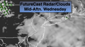
Wednesday:
Partly sunny.. Highs in the lower 40s.
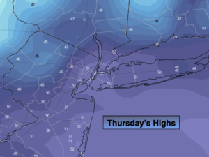
Thursday:
Partly sunny.. Highs in the lower 40s.
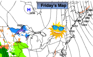
Friday:
Sun and clouds. Scattered flurries. Highs in the upper 30s.
Saturday:
Mostly sunny and cold. Highs in the mid 30s.