Synopsis:
High pressure will move off the Northeast coast tonight and Friday. Clouds will dominate with high temperatures once again going above normal.
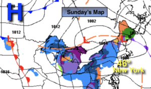
A storm will develop off the East coast on Saturday. The storm will be far enough offshore to spare the region of precipitation. Sunday- Ground Hog Day, will be breezy with a mix of clouds and some sun. Readings this weekend will be above the average high of 39º.
A warmup is expected next week. Readings will reach the 50s through Wednesday! It won’t be feeling like February; it’ll feel more like early Spring. The search for snow continues.
Stay Tuned.
Keep it here for a no nonsense, no hype forecast.
Tonight:
Partly cloudy. Lows around 30º in the City, the teens and 20s inland. Light Northeast winds.
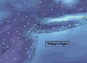
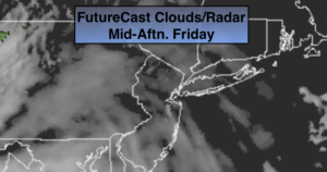
Friday:
Mostly cloudy. Highs in the lower 40s. East winds less than 5mph.
Saturday:
Mostly cloudy. Highs in the lower to mid 40s.
Sunday:
Sun and clouds. Highs in the mid 40s.
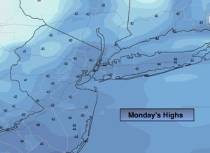
Monday:
Partly sunny and much milder. Highs in the lower 50s.
Tuesday:
Mostly cloudy. Very mild. Spotty showers are possible. Highs in the upper 50s.