Synopsis:
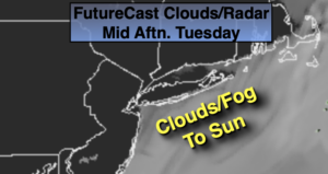
High pressure over the Atlantic will cause the wind to blow out of the South. This will result in above average temperatures with clouds and fog during the morning hours that will give way to some sunshine through Wednesday. It will be cooler at the coast. The average high temperature is 74º.
By Thursday moisture will ride up the Piedmont. Skies will be mainly cloudy and spotty showers are possible.
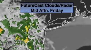
On Friday, a cool front will approach. Ahead of the front it will be warm and humid. Clouds and hazy sun is expected with scattered showers and possibly a thunderstorm.
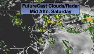
The front will be slow to exit resulting in a showery start to Saturday. Hopefully by afternoon the system will push East and the sun will return. Fingers crossed.
Stay Tuned.
Keep it here for a no nonsense, no hype forecast.
Today:
Morning clouds and fog, otherwise partly sunny. Highs in the 70s to near 80º. Cooler at the coast. East to Southeast winds at 5-10mph.
Tonight:
Mostly cloudy with patchy fog. Lows around 60º. South winds less than 5mph.
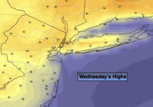
Wednesday:
Morning clouds and fog will give way to mostly sunny. Highs in the upper 70s. Cooler at the coast.
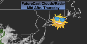
Thursday:
Mostly cloudy. Spotty showers. Highs in the mid to upper 70s. Cooler at the coast.
Friday:
Hazy, warm and humid. Scattered showers and storms. Highs in the lower 80s.
Saturday:
Morning showers. Some afternoon sun. Highs in the upper 70s.