
Synopsis:
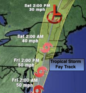
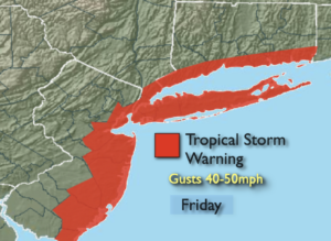
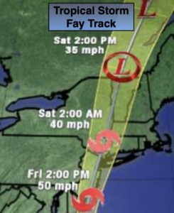
Tropical Storm Fay will move North along the Delmarva coast and into our area today. A Tropical Storm Warning is in effect along the coast including all of New York City and parts of urban New Jersey through Friday (see map above).
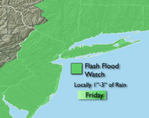
A band of rain will work from North to South this morning into the afternoon. The the rain will be torrential at times. A Flash Flood Watch is in effect for the entire region. One to three inches of rain will cause local flooding. Please do not drive through a flooded roadway; you don’t know how deep the water is. TURN AROUND, DON’T DROWN.
Tropical storm force wind gusts of 40-50mph are expected along the coast. The winds will be lighter inland. Do not be surprised if a Tornado Watch is issued sometime today.
High surf will pound the coast, but coastal flooding at this time looks to be minimal. JMW will continue to monitor the situation and give you the very latest. The rain will taper off from South to North later today and this evening.
The sun will return on Saturday behind the departing storm. Spotty storms are possible during the afternoon. The tropical feel will continue. Sunday will be bright and hot.
Typical July conditions will continue through next week.
Stay Tuned.
Keep it here for a no nonsense, no hype forecast.
Today:
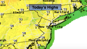
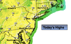
Cloudy. Humid. Scattered showers during the morning will turn into waves of heavy rain and gusty winds. Thunderstorms are likely. Highs around 80º. East winds increasing to 15-25mph with gusts to 40-50mph along the coast.
Tonight:
Showers ending from South to North. Lows in the mid 70s in the City, around 70º inland. Winds becoming Southwest at 5-10mph.
Saturday:
Becoming partly sunny. Humid. Scattered afternoon showers and storms. Highs in the upper 80s.
Sunday:
Hazy, very warm and humid. Highs in the upper 80s.
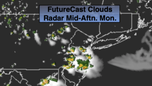
Monday:
Hazy, hot and humid. Spotty PM storms. Highs around 90º.
Tuesday:
Hazy, very warm and humid. Highs in the upper 80s.