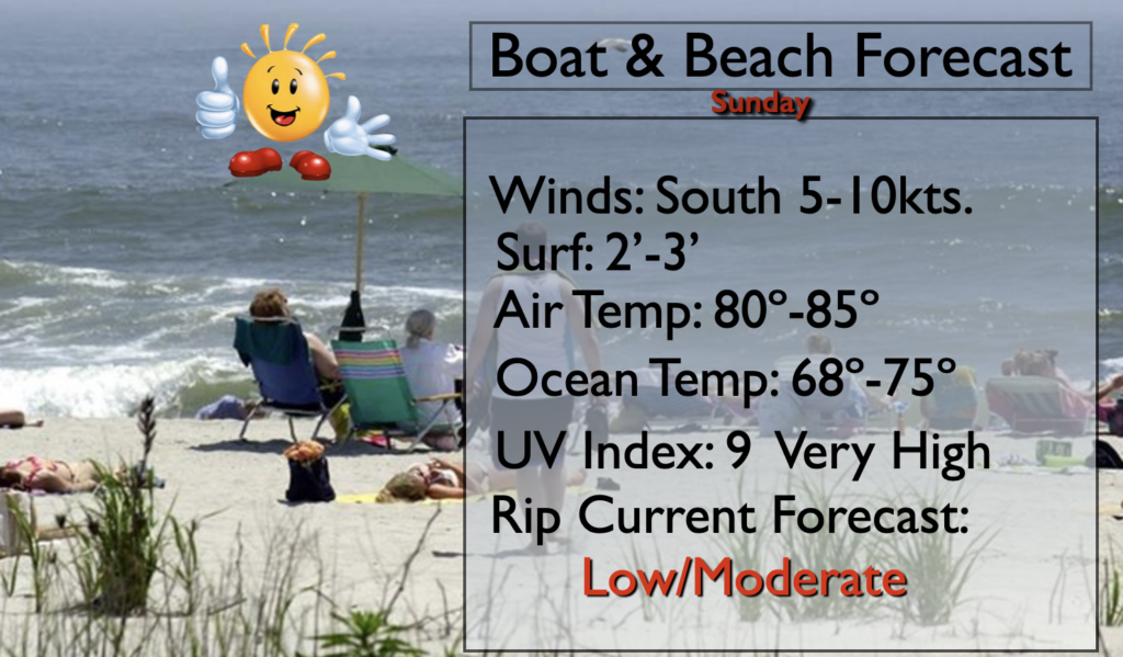
Synopsis:
The 4th of July weekend will continue to be memorable. A sizzlin’ Sunday is in the forecast. A South wind around weak high pressure offshore will be responsible for the heat. The sun will dominate our sky. Please slather on the sunscreen! The UV index is a very high 9.
The heat will be on through the upcoming week. Temperatures will flirt with 90º through Friday. Hazy sun is expected much of the time with moderate to high levels of humidity. Isolated afternoon storms are possible. Typical July conditions.
Stay Tuned.
Keep it here for a no nonsense, no hype forecast.
Today:
Sunny. Highs around 90º. Winds becoming South at 5-10mph.
Tonight:
Partly cloudy. Warm. Lows around 75º in the City, the 60s to lower 70s inland. Light winds.
Monday:
Partly sunny and hot. Isolated afternoon storms. Highs in the lower 90s.
Tuesday:
Hazy, warm and humid. Isolated afternoon storms. Highs in the mid to upper 80s.
Wednesday:
Hazy, hot and humid. Isolated afternoon storms. Highs around 90º.
Thursday:
Hazy, hot and humid. Isolated afternoon storms. Highs in the lower 90s.