Synopsis:
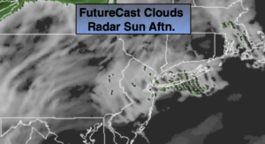
The Holiday weekend will feature sun and clouds and tolerable readings both days as high pressure moves in from the West. Sunday will be the brighter of the two days. Readings will be several degrees above the average high of 49º.
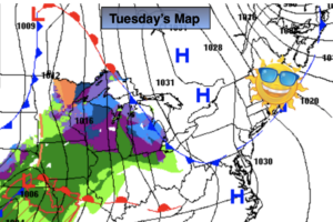
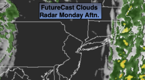
An intense storm will develop over the Southern Appalachians on Monday and move North. The track will take it to our West which is a balmy, wet scenario for the East coast. Rain is expected to develop during the morning and become heavy for a time. Winds will increase from the Southeast and become quite strong by midday into the early afternoon.
December’s debut on Tuesday will be cooler and drier behind the storm.
Tranquil conditions are expected through midweek along with a cool down under the influence of a Northwesterly flow.
Stay Tuned.
Keep it here for a no nonsense, no hype forecast.
Today:
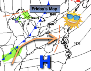
Becoming mostly sunny. Mild. Highs in the mid 50s. Northwest winds at 8-15mph.
Tonight:
Clear and chilly. Lows around 40º in urban areas, the 20s and 30s inland. West to Northwest winds at 5mph.
Sunday:
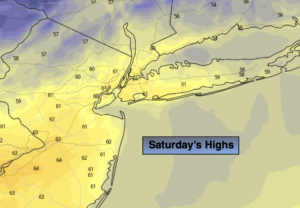
Sunny. Cooler. Highs in the lower 50s.
Monday:
Rain developing during the morning. A period of heavy rain is likely along with increasing winds. Balmy. Highs around 60º.
Tuesday:
Sun and clouds. Spot shower possible. Highs in the lower to mid 50s.
Wednesday:
Sunny and chilly. Highs in the mid 40s.