Synopsis:
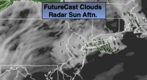
Sunday will be a complete 360º from Saturday’s delightful. conditions. High pressure will move East to the Canadian maritimes. This will result in increasing moisture as the wind blows off the cooler Atlantic. Today will be mainly grey with patchy drizzle developing durning the afternoon. It’ll be a much cooler day with readings remaining several degrees below the average high of 52º.
A few showers are possible on Monday with an approaching front. The sun should return during the afternoon.
Tuesday will be bright and cool with another area of high pressure moving in.
A cool front will approach on Wednesday with any sun giving way to clouds. At this time, the Thanksgiving forecast will include showers as a front moves through. Whether it’s a quick moving system or an all day rain remains to be seen. As of this writing, I’m being optimistic with a return of some sun by afternoon.
Stay Tuned.
Keep it here for a no nonsense, no hype forecast.
Today:
Cloudy. Much cooler. On and off drizzle is possible during the afternoon. Highs in the upper 40s. East winds at 5-10mph.
Tonight:
Areas of light rain and drizzle. Temperatures actually rising into the lower 50s in the City, the 40s inland. East to South winds at 5-10mph.
Monday:
Morning showers, afternoon sun. Highs in the mid 50s.
Tuesday:
Sunny. Chilly. Highs in the upper 40s.
Wednesday:
Sun to clouds. Highs in the mid 50s.
Thanksgiving:
Morning showers. Some Afternoon sun. Highs in the upper 50s.