Synopsis:
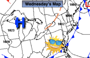
High pressure near Chicago will build into the region from the West for the rest of the week. Abundant sunshine and seasonal temperatures are anticipated for the last few days of Spring.
Temperatures will heat up on Saturday as the winds turn to the Southwest. A spotty afternoon thunderstorm is possible in the building humidity.
Father’s Day Sunday, which by the way is the first day of Summer, will be a winner. Sunny and warm conditions are expected.
Stay tuned.
Keep it here for a no nonsense, no hype forecast.
Today:
Sunny. Highs around 80º. Northwest winds at 5-10mph.
Tonight:
Clear and much cooler than recent nights. Lows near 60º in urban areas, the 40s and 50s inland. Northwest winds less than 5mph.
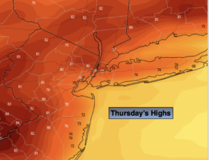
Thursday:
Sunny. Highs in the upper 70s.
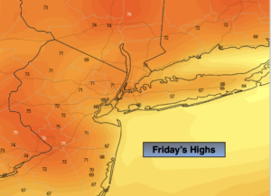
Friday:
Mostly sunny. Warmer. Highs in the lower 80s.
Saturday:
Hazy, warm and humid with scattered afternoon storms. Highs in the upper 80s.
Sunday:
Sunny and warm. Less humid. Highs in the upper 80s.