Synopsis:
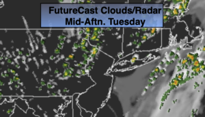
A mix of sun and clouds is expected for today. The humidity will be much lower than yesterday. A spot shower is possible during afternoon as the last in a series of disturbances moves through. Most of the region will remain dry.
High pressure will build into the region from the West for the rest of the week. Abundant sunshine and warm temperatures are anticipated.
Temperatures will heat up on Saturday as the winds turn to the Southwest. A spotty afternoon thunderstorm is possible in the building humidity.
Stay tuned.
Keep it here for a no nonsense, no hype forecast.
Today:
Partly sunny. An isolated shower is possible in the afternoon. Highs in the upper 70s. Northwest winds at 5-10mph.
Tonight:
Clear. Cooler than recent nights. Lows in the lower 60s in the City. The lower 50s inland. Northwest winds at 5mph.
Wednesday:
Sunny. Highs around 80º.
Thursday:
Sunny. Highs around 80º.
Friday:
Mostly sunny. Warmer. Highs in the lower to mid 80s.
Saturday:
Hazy, warm and humid with scattered afternoon storms. Highs in the upper 80s.