Synopsis:
Today will be a typical August day. It’ll be hazy with seasonal temperatures (mid 80s) with moderate levels of humidity. An isolated PM shower is possible.
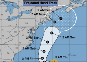
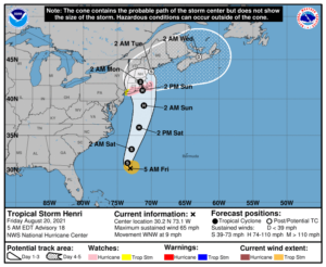
Now for the weekend and Tropical Storm Henri. The storm is forecast to become a hurricane and move up the coast. The projected track is above. Eastern Long Island to Southern New England has the greatest potential of a landfall sometime Sunday. High surf and dangerous rip currents are a definite both weekend days.
When tropical offshore systems move up and off our coast many times an area of showers or storms moves ahead of it without a direct hit from the system. This looks to be the case for Saturday as the storm brings up some moisture and an upper level low moves toward the region. Sunday should feature some sun along with the chance of spotty showers from NYC to the West. Areas East of NYC may get into the bands of Henri with heavier rain and gusty winds. It all depends on the track.
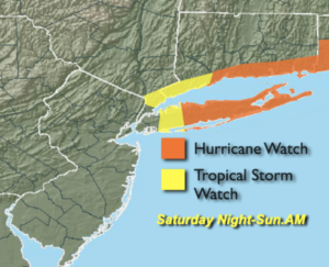
Tropical Storm Watches and Hurricane Watches have been posted for areas East of NYC (map above). This is a good time to get hurricane prepared for these regions.
I’ve been forecasting in the NYC tri-state area for many years and I never let my guard down until a tropical system is North of our latitude. Please check back frequently to JMW for updates.
Hazy, warm and humid conditions will be with us for early next week.
Keep it here for a no nonsense, no hype forecast.
Stay tuned.
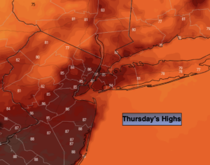
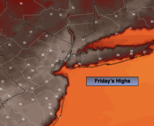
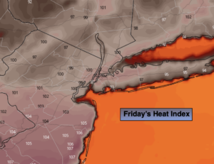
Friday:
Sun and clouds. Humid. An isolated shower. Highs in the mid 80s. Northwest winds at 5-10mph.
Tonight:
Spotty evening shower, otherwise partly cloudy. Muggy. Lows in the lower 70s in urban areas the 60s inland. Light and variable winds.
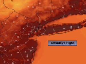
Saturday:
Mostly cloudy. Humid. Scattered showers. Highs in the lower 80s.
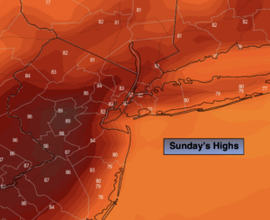
Sunday:
Clouds, some sun. Humid. Spotty showers. Heavier rain and high winds possible for Eastern areas. Highs in the lower to mid 80s.
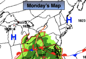
Monday:
Partly sunny. Humid. Highs in the mid to upper 80s.
Tuesday:
Mostly sunny.Very warm and humid. Highs in the upper 80s.