Synopsis:
A large dome of high pressure over the Northern plains will result in a wind from Canada the next several days. Today will feature sunny skies and the coldest daytime high temperatures so far this season. Readings will be eight to ten degrees below the average high of 59º.
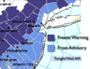
Tonight will be the coldest night of the season so far. Readings inland will be at or below freezing. Temperatures along the urban corridor will dip into the upper 30s. A Freeze Warning has been posted. Please bring in any potted plants or they will be gone by morning. A Frost Advisory is in effect for many other areas just outside of the urban corridor.
Temperatures will continue to be chilly right into the weekend. A nip in the air for sure. At least it will be rain-free as the big dome of high pressure continues to dominate.
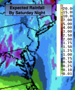
There will be a storm developing off the Southeast coast Saturday. The storm should remain offshore and not a bother to the region.
Keep it here for a no hype-no nonsense forecast.
Stay tuned.
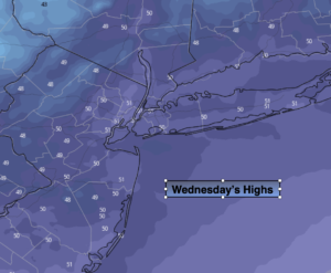
Wednesday:
Sunny. Chilly. Highs in the lower 50s. Northwest winds at 5-10mph.
Tonight:
Mostly clear and cold. Lows in the upper 30s in City, near freezing or below inland. Northwest winds at 5mph.
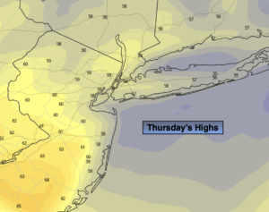
Thursday:
Mostly sunny. Highs in the upper 40s.
Friday:
Sunny. Highs in the lower 50s.
Saturday:
Mostly sunny. Highs in the lower to mid 50s.
Sunday:
Clouds to increasing sunshine. Highs in the mid 50s.