Synopsis:
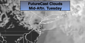
Today will be mainly cloudy. If we’re lucky the skies may brighten this afternoon. Readings will be seasonal in the upper 60s. Temperatures well to the South and West of the City (away from the influence of the wind off the cold Atlantic) may reach into the 70s. Late day and evening showers are possible, otherwise the majority of the day will be dry.
Showers are likely tonight with another weak disturbance passing through.
We’ll continue with showers on Wednesday with the passage of a cool front. Temperatures will be just below average.
We’ll finally dry out on Thursday as high pressure dominates. Skies will be mainly sunny.
Friday may start off with a bit of sun but clouds will roll in as low pressure develops offshore and upper level energy swings through. Showers are likely during the afternoon as these systems affect the region. It’ll be cool.
Sun and clouds are expected for Saturday with readings several degrees below the average high of 70º.
Stay tuned.
Keep it here for a no nonsense, no hype forecast
Today:
Mostly cloudy, skies may brighten some during the afternoon. Highs in the 60s, the 70s well South and West. Northeast to East winds at 5-10mph.
Tonight:
Showers likely. Lows in the 50s throughout. East winds at 5mph.
Wednesday:
Mostly cloudy. Scattered showers. Highs in the mid to upper 60s.
Thursday:
Mostly sunny. Highs in the mid 60s.
Friday:
Sun to clouds. Showers are possible later in the day. Cooler. Highs in the lower 60s.
Saturday:
Partly sunny. Cool. Highs in the lower 60s.