Synopsis:
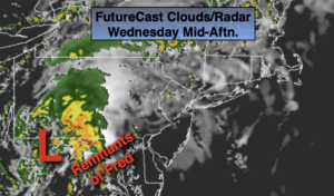
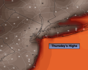
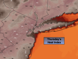
The remnants of Tropical Storm Fred moved through the region last night with areas of heavy rain. Today we’ll be left with the tropical airmass from the system. A mix of sun and clouds is expected. It’ll be warm and very humid.
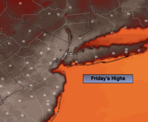
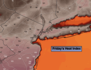
Friday will be a typical August day. It’ll be hazy with seasonal temperatures (mid 80s) with moderate levels of humidity.
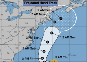
Now for the weekend and Tropical Storm Henri. The storm is forecast to become a hurricane and move up and well off our coast. The projected track is above. Southern New England has the greatest potential of seeing any affects from Henri. Our local beaches will experience high surf and dangerous rip currents. Please swim by guarded beaches.
In our region showers are possible Saturday as the storm brings up some moisture and an upper level low moves through. Sunday should feature some sun along with the chance of spotty showers.
I’ve been forecasting in the NYC tri-state area for many years and I never let my guard down until a tropical system is North of our latitude. Please check back frequently to JMW for updates.
Keep it here for a no nonsense, no hype forecast.
Stay tuned.
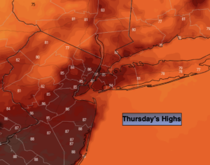
Thursday:
Sun and clouds. Warm and humid. Highs in the mid 80s. Southwest to West winds at 8-15mph.
Tonight:
Partly cloudy. Muggy. Lows in the lower 70s in urban areas the 60s inland. West to Northwest winds at 5mph.
Friday:
Sun and clouds. Highs in the mid 80s.
Saturday:
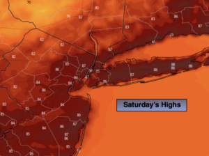
Mostly cloudy. Scattered showers. Highs in the lower to mid 80s.
Sunday:
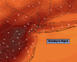
Sun and clouds. Spotty showers. Highs in the mid 80s.
Monday:
Partly sunny. Highs in the mid to upper 80s.