Synopsis:
A tropical airmass will move in from the South today. Isolated storms are possible just about anytime, but most of the time it’ll be dry. Readings will get above average by a few degrees (average high is 84º) for the first time in several days. The humidity will be a big player making it feel more like the 90s.
August’s ugly side will be with us the rest of the week as high pressure builds over the Western Atlantic- a Bermuda high. This is very typical for this time of the year. The dog days of August will be upon us. Hazy, increasingly hot and humid conditions can be expected. A late day scattered storm is possible each and every day.
Relief will most likely arrive by Sunday.
Keep it here for a no nonsense, no hype forecast.
Stay tuned.
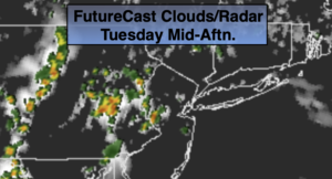
Tuesday:
Hazy. Very warm and humid. Isolated shower or storm possible. Highs in the upper 80s. Southeast to South winds at 8-12mph.
Tonight:
Mostly cloudy. Early storm possible. Muggy. Lows in the mid 70s in urban areas, near 70º inland. Southeast winds at 5mph.
Wednesday:
Hazy, hot and humid. Highs in the lower 90s. Heat index near 100º.
Thursday:
Hazy, hot and humid. Isolated PM storm. Highs in the lower to mid 90s. Heat index 105+º.
Friday:
Hazy, hot and humid. Scattered PM storm. Highs in the lower to mid 90s. Heat index near 100º-105º.
Saturday:
Hazy, hot and humid. Scattered PM storms. Highs around 90º.