Synopsis:
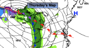
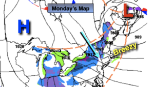
Low pressure will move out of Northern New England and into Southeastern Canada today. Strong high pressure will move South into the Northern Great Lakes. The combination of these two systems will result in gusty winds and chilly readings for today. Isolated showers are possible from late effect streamers and upper level energy moving through. More clouds than sun is expected with readings well below the average high of 54º.
Tonight will be clear and cold. Many urban areas will experience their coldest night of the season so far.
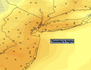
Tuesday will be bright and chilly as high pressure moves in from the Northwest.
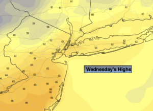
Readings will pop almost ten degrees Wednesday and stay warm through Thursday as a Southwesterly wind around high pressure takes hold. In fact, Thursday’s highs will feel more like Spring with temperatures nearly fifteen degrees above average.
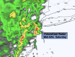
A cool front will move through Thursday night with showers.
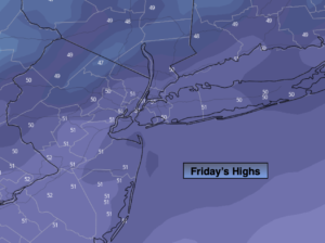
November will return on Friday as another chilly airmass moves in.
Stay tuned.
Monday:
Clouds and sun. Brisk and chilly. Isolated showers possible. Highs in the upper 40s. West winds at 10-20mph with gusts to 30mph. Wind chills will be near 40º.
Tonight:
Mostly clear. Cold. Lows in the mid to upper 30s in the City, the upper 20s to around 30º inland. West winds diminishing to 8-15mph.
Tuesday:
Sunny. Cool. Highs around 50º.
Wednesday:
Sunny. Milder. Highs in the mid to upper 50s.
Thursday:
Partly sunny. Warm. Highs in the mid to upper 60s.
Friday:
Partly sunny. Colder. Highs in the upper 40s.