Synopsis:
The storm that gave many areas significant snow is now in Eastern Canada. Today will be bright and very cold as high pressure moves toward the region. The winds will at least not be an issue.
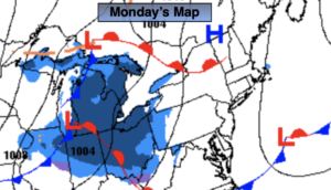
Temperatures will crack freezing on Monday and February debut will be seasonal. Both days will feature plenty of sun as high pressure moves off the coast.
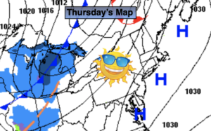
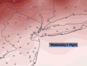
A mild Southwest flow will develop Wednesday and Thursday. Wednesday’s readings under a mix of sun and clouds will be several degrees above average. Thursday will be Spring-like with scattered showers as a front approaches from the West.
Catch me on Fox Business News from 6-9am today and on the Fox Weather App and streaming service on Tubi from 6am-Noon!
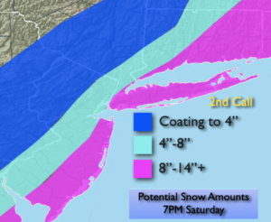
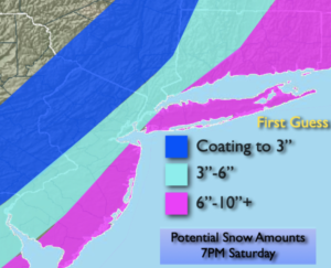
Stay tuned.
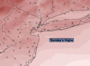
Sunday:
Mostly sunny and cold. Highs only in the mid 2os. West winds at 5-10mph.
Tonight:
Partly cloudy. Cold. Lows in the lower 20s in the City, the single digits inland. Light winds.
Monday:
Sunny. Highs in the mid 30s.
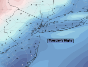
Tuesday:
Mostly sunny. Seasonal. Highs in the upper 30s.
Wednesday:
Partly sunny. Milder. Highs in the mid 40s.
Thursday:
Mostly cloudy with scattered showers. Spring-like. Highs in the lower 50s.