Synopsis:
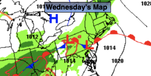
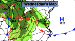
A warm front will approach on Wednesday. Any morning sun will give way to increasing clouds. Late day showers are possible. Readings will be more seasonable. The average high is in the lower 60s.
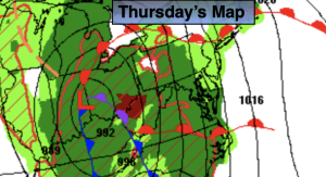
Low pressure will move to our South on Thursday. On and off showers are expected. It’ll be chilly with the flow off the colder Atlantic.
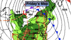
On Friday we should hopefully remain dry. Weakening low pressure over the ocean will keep the clouds dominant.
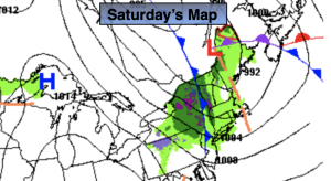
A cool front will sweep offshore Saturday fairly uneventful. Morning clouds will give way to sun. Typical temperatures are expected. Sunday will be bright and slightly cooler as high pressure moves in.
Stay tuned.
Keep it here for a no nonsense, no hype forecast.
Wednesday:
Early sun to late showers. More seasonable. Highs in the lower 60s. East to Southeast winds at 5-10mph.
Tonight:
Showers. Lows in the 40s throughout. East winds less than 8-12mph.
Thursday:
On and off showers. Chilly. Highs around 50º.
Friday:
Mostly cloudy. Cool. Highs in the mid 50s.
Saturday:
Clouds to sun. Highs in the lower to mid 60s.
Sunday:
Mostly sunny. Cooler. Highs in the upper 50s.