Synopsis:
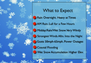
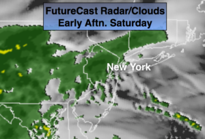
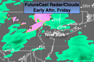
March will come in like a lion. A rapidly developing storm will be off the Long Island coast today. The exact location of this second storm and how it moves will determine our specific weather conditions. The latest computer models continue with the storm bombing off or over Eastern Long Island and doing a loop de loop just offshore. There maybe a lull in the rain during the morning hours but once that storm does that loop off the coast the backside of the storm will affect the region. This is when rain will go over to wet snow at times mainly away from the coast. The accumulation will depend on your elevation. Some region may pick up a significant amount. Don’t be surprised even closer to the coast if a heavy wet snow falls for a time.
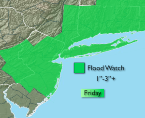
A Flood Watch has been posted for Friday for potential of 1-3″ of rain. The ground is saturated and heavy rain will quickly lead to flooding of streets, streams and creeks.
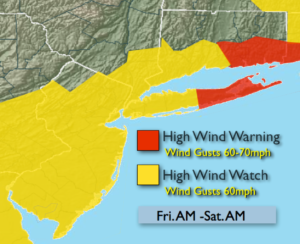
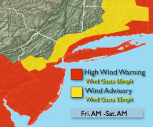
High Wind Warnings and advisories have been posted for the potential of wind gusts of 5o to 60mph. Power outages are possible.
Coastal tidal flooding is possible at the time of high tide Friday and Saturday. Tides of 1-3′ above normal is expected.
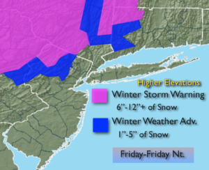
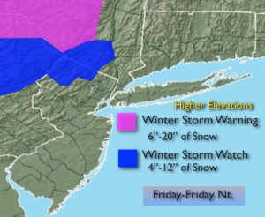
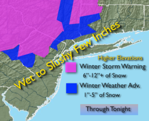
Winter Storm Warnings and advisories have been posted for heavy wet snow over the higher elevations inland.
Please check in frequently as this could become a rapidly deteriorating situation on Friday.
The storm finally pulls off our coastline to the Southeast Friday night, ending the precipitation but the winds will be strong.
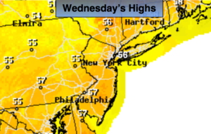
Saturday will be very windy with clouds and sun. Sunday the winds will ease some under sunny skies. Both days will feature highs in the 40s.
Stay tuned.
Today:
Rain. A mix of rain and wet snow is possible inland. There is a moderate potential for the rain to completely go over to wet snow inland. An accumulation is likely over the higher elevations and may occur closer to the coast. Becoming very windy. Highs in the 40s, 30s inland. North to Northwest winds at 20-35mph with gust to 5o to 60mph.
Tonight:
Rain and wet snow. Very windy. Lows in the mid 30s in the City, near freezing inland. Northwest winds at 20-35mph with gusts to 55mph.
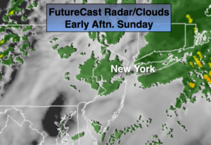
Saturday:
Clouds and some sun. Windy. Highs in the mid 40s.
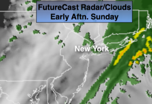
Sunday:
Mostly sunny. The winds will ease some. Highs in the mid 40s.
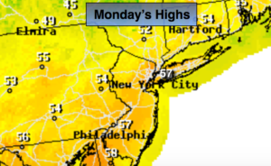
Monday:
Sunny. Highs in the mid to upper 40s.
Tuesday:
Partly sunny. Highs in the mid to upper 40s.
Keep it here for a no nonsense, no hype forecast.