Synopsis:
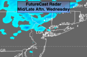
A persistent Northwesterly flow will continue resulting in colder than average temperatures right through the weekend. The culprit, a stationary storm in Eastern Canada and another cold front working toward the area later tomorrow. A mix of sun and clouds is expected through Sunday. An upper low will move over the region today. This feature will cause scattered snow showers into this evening. Some areas, mainly to the North may be up a quick coating. Please use caution as any snow shower could be heavy for a short period of time. Another round of rain or snow showers is possible late afternoon and evening tomorrow with the cold front.
There has already been chatter about another storm affecting the area next Tuesday. Please do not listen to those predicting another snow; its totally unrealistic. The models do have an area of low pressure on the map over the Eastern states, but where it goes? Many days to watch this unfold.
Stay tuned.
Tonight:
An evening snow shower, otherwise, partly cloudy. Breezy. Lows near freezing in the City, the 20s inland. West winds 15-30mph.
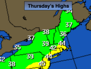
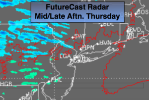
Thursday:
Partly sunny, breezy. Rain and snow showers possible later in the day and during the evening. Highs in the lower to mid 40s. West winds at 10-20mph.
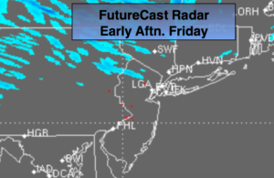
Friday:
Partly sunny, windy and cold. Highs in the upper 30s.
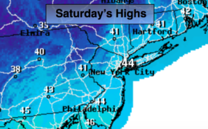
Saturday:
Partly sunny. Highs in the lower to mid 40s.
Sunday:
Sunny. Highs in the mid 40s.
Monday:
Mostly sunny. Highs in the mid 40s.
Keep it here for a no nonsense, no hype forecast.