Synopsis:
High pressure continue to nose in from Canada resulting in chilly but tranquil conditions today. Daylight Saving time began 2AM this Morning. Hopefully, you didn’t forget. We Spring ahead-turn your clocks ahead one hour. It’s also a good time to change the batteries in your smoke and carbon monoxide detectors.
A storm will be developing today over the Southern states. Will that storm move out the sea to the South or will it take a turn up the coast? The computer models take the storm just far enough off the coast to spare the area of a significant snowfall. Long Island and Connecticut have the best chance to see a decent snowfall. The full fury of the storm will stay offshore. Possible snow amounts will discussed in the afternoon update. The snow will end from West to East after midday Tuesday.
Whatever the case, it will be cold and breezy behind this system into midweek next week with scattered flurries.
Stay tuned.
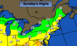
Today:
Partly sunny. Highs in the mid 40s. Northwest winds at 5-10mph.
Tonight:
Clear to partly cloudy. Lows near freezing in the City, the 20s inland. North to Northeast winds at 5mph.
Monday:
Mostly cloudy. Low threat for some snow late in the day and at night, especially by the coast. Some rain is possible at the coast. Highs in the upper 30s.
Tuesday:
Mostly cloudy with a low threat of some snow, especially east in the morning. Becoming partly sunny. Highs in the upper 30s.
Wednesday:
Clouds and sun, breezy and chilly. Scattered flurries. Highs in the upper 30s.
Thursday:
Partly sunny, not as harsh. Highs around 40º.
Keep it here for a no nonsense, no hype forecast.