Synopsis:
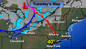
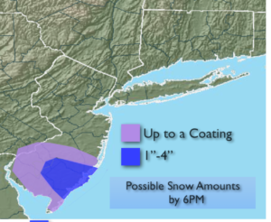
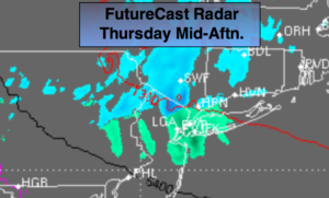
High pressure will remain anchored along the Eastern seaboard through end of the week. Today an upper low will ride underneath the surface high. This will result in cloudy skies. A period of light snow/mix or light rain by the coast is possible (map above). A light coating is possible North and West of the City. This will not be a big deal.
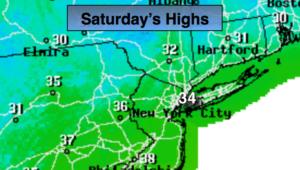
Snow lovers you’ll have to wait (for the real accumulating snow). In fact, the wait maybe a while as the Pacific jet stream is dominating. This set up will keep the Arctic air banked up in Canada and a storm track that is not favorable for snow in our area. The next chance of precipitation will be Friday night into Saturday. Rain is expected. Highs on Saturday will be around 50º! The rain will taper off by Saturday Afternoon.
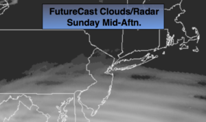
The second push of moisture with a second low is forecast to stay mainly to the South and East of the region on Sunday but a bit of rain or showers may work in. Mostly cloudy skies are expected. The confidence in Sunday’s forecast is low. Hey, I tell it like it is.
You know where to find a no hype, no nonsense forecast.
Stay tuned.
Today:
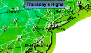
Cloudy. A period of light snow, mix or rain depending on your location.. Highs in the mid to 30s to around 40º. East winds at 5-10mph.
Tonight:
Scattered areas of light rain. A spotty light mix inland. Lows in the mid to upper 30s in the City, the near 30º inland. Northwest to East winds at 5mph.
Friday:
A bit of sun, otherwise clouds will dominate. Milder. Highs in the upper 40s.
Saturday:
Periods of rain. Rain will end by early afternoon. Highs near 50º.
Sunday:
Mostly cloudy. A bit of light rain possible. Highs in the mid 40s.
Monday:
Partly sunny. Seasonal. Highs in the mid 40s.
Keep it here for a no nonsense, no hype forecast.