Synopsis:
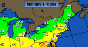
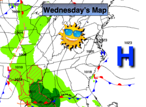
High pressure will move over the region today (first map above). Abundant sunshine and seasonal readings will be with us. The average high is 43º.
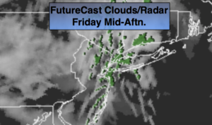
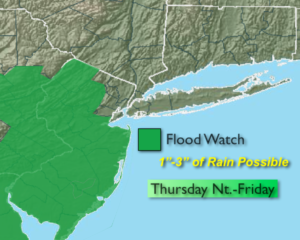
The next weather maker moves in later Thursday afternoon through Friday. The day will start with sun and end with rain. The storm will develop over the Northern Gulf of Mexico and move up to our West. This is a mild scenario meaning rain and not snow. The storm will bring up copious amounts of moisture from the tropics. The rain cloud be heavy at times Thursday night and Friday morning. A Flood Watch has been issued for much of NJ (2nd map above). One to three inches of rain is likely. We all know we do not need any more rain. River and streams are running high and the ground is saturated. Flooding could be a concern. The Flood Watch will most likely be extended to include the rest of the tri-state area tomorrow. Ironically Friday Winter arrives at 5:23EST. It’ll won’t anything like the season as readings will approach 60!
We’ll dry out this weekend. A mix of sun and clouds is expected. Temperatures will be in the 40s.
The chances of a white Christmas are slim to none. There are no storms showing up in the weather crystal ball. A few rain or snow showers may occur but it shouldn’t be enough to cover the ground for a White Christmas.
You know where to find a no hype, no nonsense forecast.
Stay tuned.
Today:
Sunny. Seasonal. Highs in the lower 40s. West to Southwest winds at 5-10mph.
Tonight:
Clear. Lows in the mid to upper 30s in the City. The 20s inland. Light Southwest wind.
Thursday:
Sun to clouds. Showers will move in later in the day from Southwest to Northeast. Highs in the mid to upper 40s.
Friday:
Periods of rain, possibly heavy at time in the morning. Balmy. Highs in the upper 50s to lower 60s.
Saturday:
Partly sunny. Highs in the upper 40s.
Sunday:
Partly sunny. Highs in the lower 40s.
Keep it here for a no nonsense, no hype forecast.