Synopsis:
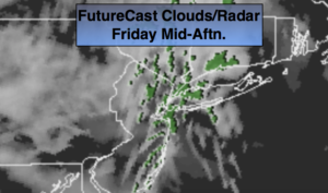
High pressure off the New England coast will be responsible for the grey skies and areas of drizzle today (FutureCast map above). Readings will be much milder as the wind turns to the Southeast.
Our next significant weather maker will be a low coming out of the Gulf of Mexico. Rain will overspread the area tonight into the first part of Saturday. There is no cold air to be found in the contiguous US for this reason rain is expected and not snow. The low will move off the coast Saturday afternoon. The rain should taper off and the second half of the day will be dry.
A second push of moisture with a second low is forecast to slide to our South on Sunday. The models were going back and forth on whether Sunday would be wet or mainly dry. It now looks like the low will have enough influence in our area to keep on and off showers in the forecast. It maybe cold enough inland for a bit of wet snow to mix in.
Looking down the pike, a cool down is expected by Tuesday, but the majority of the week looks storm free.
You know where to find a no hype, no nonsense forecast.
Stay tuned.
Today:
Mainly cloudy with areas of drizzle. Milder. Highs in the upper 40s to around 50º. East to Southeast winds at 5-10mph.
Tonight:
Periods of rain. Much warmer than recent nights. Lows in the mid 40s in the City (thats the actual average high for the date), the 30s inland. Winds becoming Northeast at 5mph.
Saturday:
Morning rain. Well North it may remain dry. Rain will end by early afternoon. Highs near 50º.
Sunday:
Cloudy with on and off rain. Wet snow may mix in inland. Highs in the lower 40s, the 30s inland.
Monday:
Partly sunny. Seasonal. Highs in the mid 40s.
Tuesday:
Partly sunny. Colder. Highs in the mid to upper 30s..
Keep it here for a no nonsense, no hype forecast.