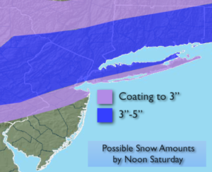
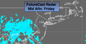
Fall Classic Friday. Warm, Sunny Weekend…


Synopsis:

High pressure will dominate the Eastern one half of the country. The cold air is banked up in Canada. Sunny and increasingly warm days are expected into the weekend. Readings will be ten to fifteen degrees above average. The average high is 63º.

The next threat of rain will not come until Tuesday as a front moves in. Enjoy!

Stay tuned.

Today:

Sunny and mild. Highs in the lower to mid 70s. Northwest winds at 5-10mph.

Tonight:

Clear. Lows in the mid to upper 50s in the City. The 40s inland. Northwest to North wind less than 5mph.

Saturday:

Sunny and warm. Highs in the mid to upper 70s.

Sunday:

Sunny. Highs in the mid 70s.

Monday:

Mostly sunny. Highs in the lower to mid 70s.

Tuesday:

Rain developing. Warm. Highs in the lower 70s.

Keep it here for a no nonsense, no hype forecast.


An October Delight. Sunny & Mild…


Synopsis:

High pressure will dominate the Eastern one half of the country. The cold air is banked up in Canada. Sunny and increasingly warm days are expected into the weekend. Readings will be ten to fifteen degrees above average. The average high is 63º.

The next threat of showers will not come until Tuesday. Enjoy!

Stay tuned.

Today:

Sunny. A top ten day. Highs in the lower 70s. Southwest winds at 8-12mph.

Tonight:

Clear. Lows in the mid to upper 50s in the City. The 40s inland. Southwest less than 5mph.

Friday:

Sunny and mild. Highs in the mid 70s.

Saturday:

Sunny and warm. Highs in the mid to upper 70s.

Sunday:

Sunny. Highs in the mid 70s.

Monday:

Sunny. Highs in the lower 70s.

Keep it here for a no nonsense, no hype forecast.


Top Ten Autumn Day. Wall to Wall Sun. Milder…


Synopsis:

High pressure system will begin to moderate today allowing the mercury once again rise to above average readings. The average high is 63º. Tranquil, pleasant conditions are expected through the weekend as a large high pressure system dominates the Eastern one half of the country.  Sunshine and mild readings will be the top story. These conditions are quite typical for October.

Stay tuned.

Today:

Sunny. A top ten day. Highs around 70º. West to Southwest winds at 5-10mph.

Tonight:

Clear and cool. Lows in the mid 50s in the City. The 40s inland. Southwest less than 5mph.

Thursday:

Sunny. Highs in the lower 70s.

Friday:

Sunny. Highs in the lower 70s.

Saturday:

Sunny. Highs in the lower 70s.

Sunday:

Sunny. Highs in the lower 70s.

Keep it here for a no nonsense, no hype forecast.


Another Chilly Night. Top Ten Autumn Day Wednesday…


Synopsis:

Chilly readings will stick around though tonight. Scattered frost is possible inland and in sheltered areas of Ocean county where a Frost Advisory is up.

The high pressure system will moderate by tomorrow allowing the mercury once again rise to above average readings. The average high is 64º. Tranquil, pleasant conditions are expected through the weekend as a large high pressure system dominates the Eastern one half of the country.  These conditions are quite typical for October.

Stay tuned.

Tonight:

Clear and chilly. Lows around 50º in the City. The 30s and 40s inland with scattered frost. Southwest to West winds at 5mph.

Wednesday:

Sunny. A top ten day. Highs around 70º. West to Southwest winds at 5-10mph.

Thursday:

Sunny. Highs in the lower 70s.

Friday:

Sunny. Highs in the lower 70s.

Saturday:

Sunny. Highs in the lower 70s.

Sunday:

Sunny. Highs in the lower 70s.

Keep it here for a no nonsense, no hype forecast.


Cold Start. Chilly Sunshine Today…


Synopsis:

Chilly readings are with us and will stick around though tonight. After a frosty morning in spots, readings will remain five degrees below average today as cold high pressure settles over the region. A nip in the air for sure.

The high will moderate by tomorrow allowing the mercury once again rise to above average readings. The average high is 64º. Tranquil, pleasant conditions are expected through the Friday as a large high pressure system dominates the Eastern one half of the country.  These conditions are quite typical for October.

Stay tuned.

Today:

Sunny and cool. Highs around 60º. Northwest winds will become Southwest at 5-10mph.

Tonight:

Clear and chilly. Lows in the lower 50s in the City. The 30s and 40s inland. Southwest to West winds at 5mph.

Wednesday:

Sunny. A top ten day. Highs around 70º.

Thursday:

Sunny. Highs in the lower 70s.

Friday:

Sunny. Highs in the lower 70s.

Saturday:

Sunny. Highs in the lower 70s.

Keep it here for a no nonsense, no hype forecast.


Frost Advisory North & West Tonight. Coldest Temps of Season So Far…


Synopsis:

Much colder readings are with us and will stick around for the next 24 hours. A Northwest flow is bringing down the coldest temperatures of the season so far. In fact, many inland areas may see there first frost tonight. A Frost Advisory has been posted North and West of the City. You may want to bring in your potted plants or flowers tonight.

The cold high will moderate by midweek allowing the mercury once again rise to above average readings. The average high is 64º. Tranquil, pleasant conditions are expected through the Friday as a large high pressure system dominates the Eastern one half of the country.  These conditions are quite typical for October.

Stay tuned.

Tonight:

Becoming mostly clear and much colder. Lows in the lower to mid 40s in the City. The 30s inland. Areas of frost North and West of the City. North winds diminishing to 5-10mph.

Tuesday:

Sunny and cool. Highs around 60º. Northwest winds will become Southwest at 5-10mph.

Wednesday:

Sunny. A top ten day. Highs around 70º.

Thursday:

Sunny. Highs in the lower 70s.

Friday:

Sunny. Highs in the lower 70s.

Saturday:

Sunny. Highs in the lower 70s.

Keep it here for a no nonsense, no hype forecast.


Spot Early AM Shower. Sun Returns. Much Cooler…


Synopsis:

A cold front moved through early this morning. Any early morning showers will end with the sun returning from West to East. Temperatures will start off below average today and Tuesday. In fact, many inland areas may see there first frost tonight. A Frost Advisory has been posted for inland areas. Tranquil, pleasant conditions are expected through the Friday as a large high pressure system dominates the Eastern one half of the country.  These conditions are quite typical for October.

Stay tuned.

Monday:

A spotty early morning shower, otherwise becoming partly sunny, much cooler and breezy. Highs in the lower 60s. Northwest winds at 10-20mph with gust to 25mph.

Tonight:

Clear and much colder. Lows in the lower to mid 40s in the City. The 30s inland. Areas of frost North and West of the City. North winds diminishing to 5-10mph.

Tuesday:

Sunny and cool. Highs around 60º.

Wednesday:

Sunny. A top ten day. Highs around 70º.

Thursday:

Sunny. Highs in the lower 70s.

Friday:

Sunny. Highs in the lower 70s.

Keep it here for a no nonsense, no hype forecast.


Clouds & Areas of Morning Drizzle.Then Sun Returns-Much Warmer…


Synopsis:

A strong Southwest flow will develop pushing temperatures some fifteen degrees above average today. Morning fog and spotty drizzle will give way to partly sunny warm conditions.

A cold front will move in tonight with a shower. The beginning of the workweek looks pleasant with a true taste of Fall arriving.

Tranquil, pleasant conditions are expected through the Friday as a large high pressure system dominates the Eastern one half of the country.

Stay tuned.

Today:

Morning clouds, drizzle and fog will give way to party sunny skies. Warm. Highs 75º-80º. Southwest winds at 10-20mph.

Tonight:

Partly cloudy with scattered showers. Lows in the upper 50s in the City, the lower 50s inland. Southwest to Northwest winds at 10-20mph.

Monday:

Partly sunny and much cooler. Highs in the lower 60s.

Tuesday:

Mostly sunny and cool. Highs around 60º.

Wednesday:

Sunny. A top ten day. Highs around 70º.

Thursday:

Sunny. Highs in the lower 70s.

Keep it here for a no nonsense, no hype forecast.


Grey Saturday. Areas of Drizzle/Spot Shower. Better, Warmer Half Sunday…


Synopsis:

The weekend looks to be much warmer than recent days as a Southwesterly flow takes hold. It won’t be a brilliantly sunny weekend though, at least for today. A weak disturbance riding along the periphery of an area of high pressure over the Western Atlantic will provide plenty of clouds today. A bit of light rain or drizzle is possible this morning. It will not be a washout. The sun should make an appearance at times during the afternoon.

By Sunday, a stronger Southwest flow will develop pushing temperatures some fifteen degrees above average. Morning fog and spotty drizzle will give way to partly sunny warm conditions. The average high for this time of the year is 65º.

A cold front will move in Sunday Night with a shower. The beginning of the workweek looks pleasant with a true taste of Fall arriving.

Stay tuned.

Today:

Mostly cloudy and mild with spotty showers or areas of drizzle mainly in the morning. Highs in the lower 70s. Northeast winds at 5mph.

Tonight:

Cloudy with areas of drizzle and fog. Mild. Lows in the mid 60s in the City, the upper 50s inland. Southeast to South winds less than 5mph.

Sunday:

Morning clouds, drizzle and fog will give way to sun. Warm. Highs near 80º.

Monday:

Partly sunny and much cooler. Highs in the lower to mid 60s.

Tuesday:

Mostly sunny and cool. Highs around 60º.

Wednesday:

Sunny. A top ten day. Highs around 70º.

Keep it here for a no nonsense, no hype forecast.


Cool Close to the Workweek. Warmer Weekend. Areas of Drizzle, Some Sun…


Synopsis:

A high pressure system over Eastern Canada will continue to supply cooler and more seasonal readings for mid-October through today. Any sunshine will give way to clouds later in the day.

The seasonal readings won’t last too long as the upcoming weekend looks to be much warmer as a Southwesterly flow takes hold once again. It won’t be a brilliantly sunny weekend though. A weak disturbance will provide plenty of clouds Saturday. A bit of light rain or drizzle is possible both Saturday and Sunday morning. It will not be a washout. The sun should make an appearance both afternoons.

A cold front will move in Sunday Night with a shower. The beginning of the workweek looks pleasant with typical readings for this time of the year.

Stay tuned.

Today:

Sun will give way to clouds. Highs in the mid 60s. East winds at 8-12mph.

Tonight:

Cloudy with areas of drizzle and fog. Lows around 60º in the City, the 50s inland. East wind at 5mph.

Saturday:

Mostly cloudy and mild with spotty showers or areas of drizzle. Highs in the lower to mid 70s.

Sunday:

Clouds and sun. Spotty morning drizzle. Warm. Highs near 80º.

Monday:

Partly sunny and much cooler. Highs in the mid 60s.

Tuesday:

Mostly sunny and cool. Highs in the lower 60s.

Keep it here for a no nonsense, no hype forecast.