Synopsis:
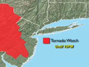
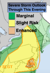
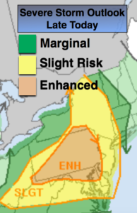
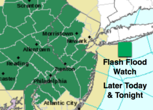
A mix of sun and clouds is expected with a few scattered showers through mid-afternoon. A stationary front dividing the tri-state today will be the focus mechanism for scattered severe thunderstorms once again (1st map above). The fireworks will develop after 4pm. Severe thunderstorms have at least one of the following criteria: winds in excess of 58mph and or one inch hail. Torrential rain and frequent cloud to ground lightning will accompany the storms. Please keep an eye to the sky for threatening weather and take shelter immediately. In addition, torrential rain is expected with the thunderstorms. One to two inches of rain is possible. A Flash Flood Watch has been posted for parts of NJ for later today and tonight (map above).
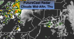
This front will stick around until Thursday night. Another round of showers and storms is expected Thursday afternoon.
A cool front will move through Thursday night with showers and storms. Friday and Saturday will be rain-free with the sun dominating. There is a chance of shower on Sunday.
Keep it here for a no nonsense, no hype forecast.
Stay tuned.
Today:
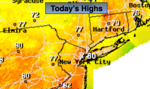
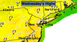
A mix of sun and clouds with a few scattered showers. Scattered thunderstorms developing later this afternoon. Highs in the mid 70s. Northeast to Southeast winds at 5-10mph.
Tonight:
Scattered strong to severe storms early, otherwise becoming partly cloudy. Lows in lower 60s in the City, the upper 50s inland. Light and variable winds.
Thursday:
Partly sunny, warm and humid. Scattered afternoon storms possible. Highs around 80º.
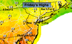
Friday:
Mostly sunny, less humid. Highs in the mid 70s.
Saturday:
Partly sunny. Highs in the mid to upper 70s.
Sunday:
More clouds. A chance of showers. Highs in the mid 70s.