Synopsis:
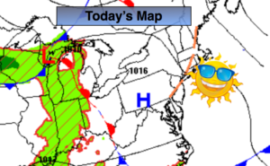
A cool front will slowly slip just to our South today. The humidity will be dramatically lower by afternoon. The front will get hung up and throw some clouds and possibly a few showers our way (mainly South & West of the City during the afternoon). This will be minor and it still will be a decent day with a mix of sun and clouds.
The beginning and mid portion of the week will be sunny with low humidity as high pressure works through the Northeast. Readings will start off pleasant then heat up toward midweek.
Stay tuned.
Keep it here for a no nonsense, no hype forecast.
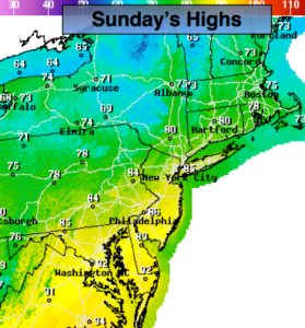
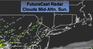
Today:
Sun and clouds, not as hot or humid. Stray showers are possible mainly South and West of the City. Highs in the lower to mid 80s. Northeast to East winds at 8-12ph.
Tonight:
Partly cloudy. Cooler than recent nights. Lows in the upper 60s in the City, the lower to mid 60s elsewhere. Light East winds.
Monday:
Partly sunny. Highs in the lower 80s.
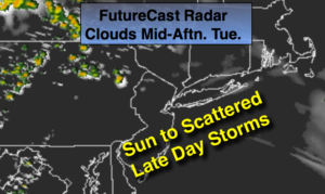
Tuesday:
Sunny. Highs in the mid 80s.
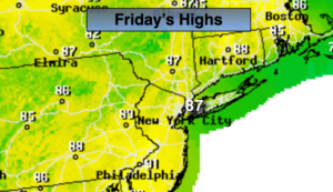
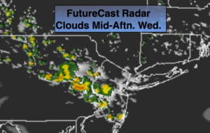
Wednesday:
Sunny. Highs near 90º.
Thursday:
Hazy, very warm and humid. Highs in the upper 80s.