Synopsis:
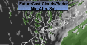
The weekend will start off grey with spotty showers as a low moves off the New England coast. If we’re lucky the sun may make an appearance during the afternoon as slightly drier air works in. Readings will be at least ten degrees below the average high of the lower 60s.
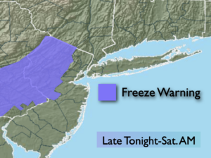
Tonight will be cold-what else is new. Mostly clear skies are expected with scattered areas of frost.
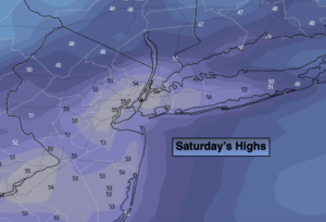
Sunday will be the better half of the weekend with mostly sunny skies and seasonal temperatures. A get outdoors day. Highs will be near average for a change as high pressure slips of the Mid-Atlantic coast.
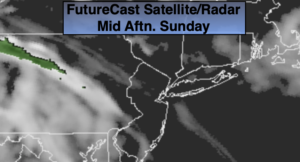
On Monday, a Developing storm will move up and off the coast. The rain shield from the system may graze the coast. The City and areas to the West will most likely remain dry.
Tuesday will be partly sunny ahead of the next cold front. Late afternoon showers are possible.
Wednesday will be blustery and chilly.
Stay Tuned.
Keep it here for a no nonsense, no hype forecast.
Today:
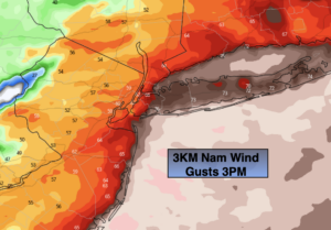
Mostly cloudy with spotty showers. The sun may make an appearance this afternoon. Chilly. Highs around 50º. North to Northwest winds at 8-12mph.
Tonight:
Mostly clear and cold. Lows in the lower 40s in the City, near freezing inland. Northwest to West winds at 5mph.
Sunday:
Mostly sunny, more seasonal. Highs in the lower to mid 60s.
Monday:
Clouds, some sun. A period of light rain is possible, at the coast. Highs in the mid to upper 50s.
Tuesday:
Partly sunny. Late day showers are possible. Highs in the lower 60s.
Wednesday:
Partly sunny, breezy and chilly. Highs only around 50º.
***Please take “social distancing” seriously during this time. We will get through this.****