Synopsis:
Scattered evening snow showers will give way to partly cloudy skies. A Freeze Warning has been posted for the area excluding New York City. Readings will be near or below freezing throughout as a cold pool of air moves over the region from Canada. Not feeling like mid April.
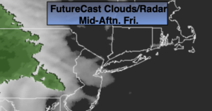
On Friday, sun will give way to clouds. Showers will move in during the afternoon from West to East with weak low pressure approaching. Readings will be ten degrees below the average high of the lower 60s.
Saturday will start off damp with showers but the sun will return during the afternoon. Sunday will be mostly sunny as high pressure settles over the area. Sunday will definitely be the better and milder half of the weekend.
On Monday, a Developing storm will move up and off the coast. The rain shield from the system will graze the coast.
Tuesday will be partly sunny ahead of the next cold front.
Stay Tuned.
Keep it here for a no nonsense, no hype forecast.
Tonight:
Partly cloudy and cold. Lows in the mid 30s in the City, the 20s to around freezing inland. Northwest to West winds diminishing to 5-10mph.
Friday:
Sun to clouds. Showers will move in during the afternoon. Highs around 50º.
Saturday:
Morning showers, otherwise becoming partly sunny. Highs in the lower 50s.
Sunday:
Mostly sunny, more seasonal. Highs in the lower 60s.
Monday:
Clouds, some sun. A period of light rain is possible, mainly at the coast. Highs in the mid to upper 50s.
Tuesday:
Partly sunny. Highs in the lower 60s.
***Please take “social distancing” seriously during this time. We will get through this.****