Synopsis:
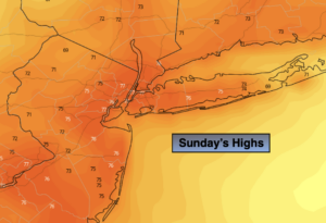
It will be a spectacular Sunday with plenty of sunshine as high pressure influences our area from the Northwest. Readings will be near the seasonal averages of the mid and upper 70s with low humidity.
The beginning and mid portion of the next week looks delightful with plenty of sun as high pressure dominates the area. Temperatures will start off near average, then pop into the 80s with tolerable humidity. There will be several top ten days!
The next chance of showers will be with an approaching front on Thursday.
Stay Tuned.
Keep it here for a no nonsense, no hype forecast.
Sunday:
Sunny and breezy. Highs in the upper 70s. Northwest winds at 8-15mph.
Tonight:
Clear and cool. Lows near 60º in the City, the the upper 40s and 50s inland. Northwest winds 5mph.
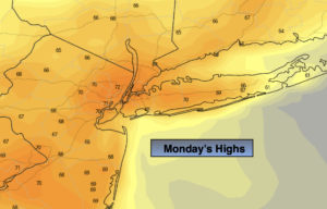
Monday:
Sunny. Comfortable. Highs in the upper 70s.
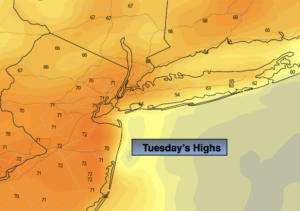
Tuesday:
Sunny. Highs in the lower to mid 80s.
Wednesday:
Partly sunny. Highs in the mid 80s.
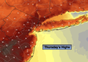
Thursday:
Clouds, some sun. Chance of showers. Highs around 80º.