Synopsis:
Low level moisture will be trapped for a majority of the day. This will result in grey skies. Skies may brighten this afternoon. Spotty showers and storms are possible during the afternoon, but the majority of the day will be dry. It’ll be warm and humid with readings near or just above the seasonal average of the lower 80s.
Spotty showers are possible early tonight.
Tuesday will feature more sunshine as the atmosphere dries out with warm readings the humidity will be lower with a Northwest wind.
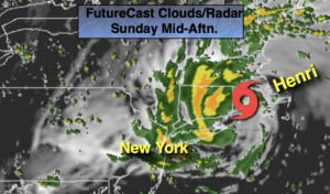
Ida is now a Tropical Storm over Mississippi. Our prayers go out to the people of the Deep South as the storm moves North.
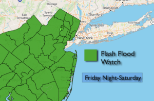
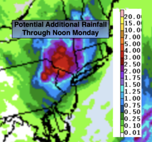
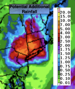
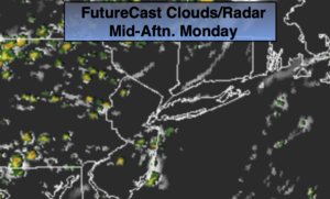
The remnants of Ida will affect our region beginning Wednesday afternoon with the increasing chance of rain. Rain is expected into a part of Thursday. Our region will not damaging winds, but an axis of heavier rain will set up as the remnants moves up the Appalachians. Exactly where the heaviest rain will fall will be determined as we get closer to the event. Needless to say, we do not need anymore rain. The grounds are saturated and rivers and streams remain high. The potential for flooding exists.
Friday will be a September gem as cooler high pressure influences the region. Abundant sunshine is expected with low humidity.
Keep it here for a no nonsense, no hype forecast.
Stay tuned.
Monday:
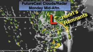
Cloudy start. Skies will become hazy. It’ll be warm and humid. Spotty showers and storms are possible during the afternoon. Highs in the mid 80s. Southwest winds at 5-10mph.
Tonight:
Scattered showers possible early, otherwise beaning partly cloudy. Lows in the lower 70s in urban areas, the 60s inland. Southwest to West winds at 5mph.
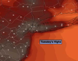
Tuesday:
Partly sunny. Warm and less humid. Highs in the mid 80s.
Wednesday:
Any morning sun will give way to clouds. Rain is possible during the afternoon. Humid. Highs in the mid 70s.
Thursday:
Rain ,possibly torrential in the morning. Rain should taper off during the afternoon. Highs in the mid 70s.
Friday:
Sunny. Much less humid. Highs in the mid to upper 70s.