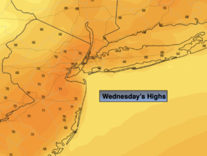
Synopsis:
Abundant sunshine and cool readings are expected for Today. Highs will be several degrees below the average of 63º. Low pressure over Southeastern Canada continues to lose it’s influence on our area and this will result in moderating temperatures.
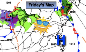
High pressure will move build over the East on Friday into Saturday. This will result in more seasonable temperatures under a bright sky. Saturday looks to be spectacular and the better half of the weekend.
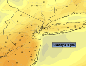
On Sunday, Atlantic low pressure will most likely affect the region with clouds and showers.
The threat of scattered showers remains on Monday as the low moves into New England. It doesn’t look to be too wet of a day.
Stay tuned.
Keep it here for a no hype, no nonsense forecast.
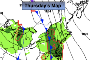
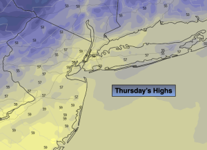
Thursday:
Mostly sunny, breezy and cool. Highs in the upper 50s. Southwest winds at 10-20mph.
Tonight:
Clear and chilly. Lows in the mid 40s in the City, the upper 20s & 30s elsewhere. Areas of frost inland. Southwest winds diminishing to 5mph.
Friday:
Sunny. Highs in the lower 60s.
Saturday:
Mostly sunny. Mild Highs in the mid to upper 60s.
Sunday:
Showers likely. Highs in the lower 60s.
Monday:
Scattered showers possible. Highs in the lower 60s.