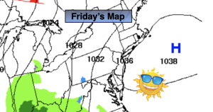
Synopsis:
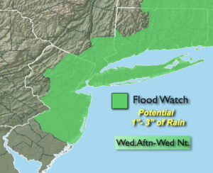
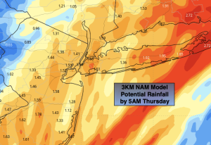
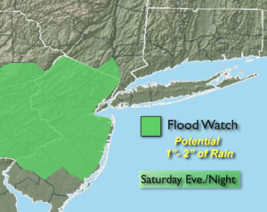
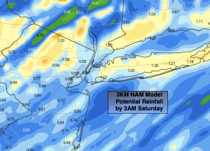
Low pressure number three of this week will move into the area this afternoon through tonight with more rain. A Flood Watch has been posted for areas West and South of the City. Between one and two inches of rain may cause local flooding of streets and streams. The rain will begin during the early to mid afternoon timeframe and become heavy for a time through the evening and early night hours.
The storm will move into New England on Sunday and strengthen considerably. This will cause winds to increase and become strong out of the Northwest. A mix of sun and clouds is expected. Scattered rain and snow showers are possible. Temperatures will drop through the 40s during the day. Average highs are in the upper 40s.
The blustery conditions will continue on Monday and the chill will remain.
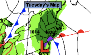
Tuesday and Wednesday will be more tranquil with milder readings as high pressure takes control.
Daylight Saving Time begins Sunday at 2am. Don’t forget to set the clocks ahead one hour before you hit the hay Saturday night. We lose an hour of sleep but get an hour more of daylight in the evening! It’s also a good reminder to change your batteries in your smoke and carbon monoxide detectors.
Stay tuned.
Keep it here for a no nonsense, no hype forecast..
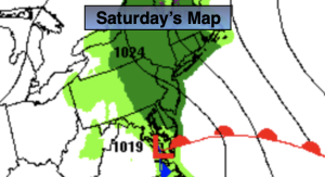
Saturday:
Cloudy. Rain developing during the afternoon. Highs in the upper 40s. Southeast winds increase to 10-20mph.
Tonight:
Rain. Heavy at times early. Rain ends late. Lows in the 40s throughout. Southeast to West winds at 10-20mph with gusts to 30mph.
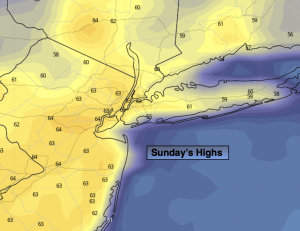
Sunday:
Sun and clouds. Windy. Chance of rain and snow showers in the afternoon. Highs around 50º in the morning then falling through the 40s.
Monday:
Partly sunny, windy and chilly. Highs in the upper 40s.
Tuesday:
Sunny and pleasant. Milder. Highs in the mid to upper 50s.
Wednesday:
Sunny. Mild. Highs in the upper 50s.