Clouds & Sun Saturday. Dry…

Synopsis:

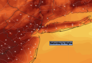
The Labor Day Weekend forecast isn’t stellar, but it’s not that bad either. Saturday will feature an approaching cool front. The latest computer guidance has the day dry under clouds and hazy sun. Scattered showers are likely at night. The front may take its sweet ol’ time moving offshore on Sunday. A few showers are possible in the morning and mainly along the coast. The majority of the day will be dry. Conditions should improve during the afternoon with the sun making a comeback. A spotty storm can’t be ruled out drink the afternoon. Labor Day will be a winner as strong high pressure over the Great Lakes brings in a refreshing airmass. Abundant sunshine and cooler temperatures are anticipated. A memorable holiday to say the least.

The fine September weather will continue into the middle of the workweek.

Stay tuned.

Keep it here for a no nonsense, no hype forecast.

Saturday:

Clouds and hazy sun. More humid. Highs around 80º. South winds at 5-10mph.

Tonight:

Mostly cloudy. Scattered showers. Muggy. Lows around 70º in the City, the 60s inland. South winds at 5 mph.

Sunday:

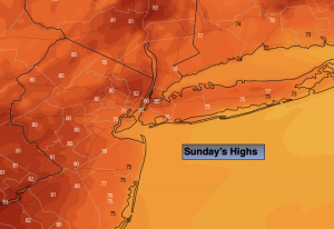
Morning showers possible. Skies should become partly sunny during the afternoon. Spotty afternoon storm. Warmer. Highs in the mid 80s.

Labor Day:

Sunny. Cooler. Highs in the upper 70s.

Tuesday:

Sunny. Highs in the mid 70s.

Wednesday:

Sunny. Highs around 80º.

Cool Getaway Day. Clouds to Some Sun. Spot Shower…

Synopsis:

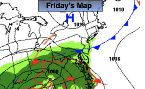
Highs pressure off the Maine coast will provide the area with a cool flow off the ocean. Readings will be nearly ten degrees below the average high of the lower 80s. Clouds will start the day with showers East of the City. The sun should shine from time to time this afternoon.

The Labor Day Weekend forecast isn’t stellar, but it’s not that bad. Saturday will feature an approaching cool front. The latest computer guidance has the day dry under hazy sun. Scattered showers are likely at night. The front may take its sweet ol’ time moving offshore on Sunday. A few showers are possible in the morning. Conditions should improve during the afternoon with the sun making a comeback. Labor Day will be a winner as strong high pressure over the Great Lakes brings in a refreshing airmass. Abundant sunshine and cooler temperatures are anticipated.

Stay tuned.

Keep it here for a no nonsense, no hype forecast.

Friday:

More clouds than sun. Spotty shower. Cool. Highs in the lower to mid 70s. East winds at 8-12mph.

Tonight:

Partly cloudy. Lows in the mid 60s in the City, around 60º inland. Southeast winds at 5 mph.

Saturday:

Hazy sun and clouds. More humid. Highs around 80º.

Sunday:

Morning showers possible. Skies should become partly sunny during the afternoon. Highs around 80º.

Labor Day:

Sunny. Highs in the upper 70s.

Tuesday:

Sunny. Highs in the mid 70s.

Much Cooler. Spot Shower…

Synopsis:

A front moving off the coast today will be a season changer. Much cooler air will arrive. Unfortunately, for today and Friday a weak disturbance will get hung up along the front resulting in more clouds and scattered showers from time to time. It will not be a washout. Readings will be several degrees below the average high of the lower 80s.

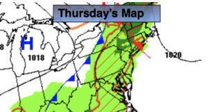
The beginning of the Labor Day Weekend has a few concerns. Saturday will feature an approaching cool front. The latest computer guidance has the day dry under hazy sun. Scattered showers and storms are possible toward evening. The front may take its sweet ol’ time moving offshore on Sunday. A few showers are possible in the morning. This is not etched in stone. Sunday may very well be dry. Conditions should improve during the afternoon with the sun making a comeback. Labor Day will be a winner as strong high pressure over the Great Lakes brings in a refreshing airmass. Abundant sunshine and cooler temperatures are anticipated.

Stay tuned.

Keep it here for a no nonsense, no hype forecast.

Thursday:

More clouds than sun. Spotty shower. Much cooler. Highs in the mid 70s. Northeast winds at 8-12mph.

Tonight:

Mostly cloudy. Spotty shower. Cooler than recent nights. Lows in the lower 60s in the City, the upper 50s to around 60º inland. Southeast to East winds at 5-10mph.

Friday:

More clouds than sun. Spotty shower. Cool. Highs in the mid 70s.

Saturday:

Hazy sun and clouds. More humid. Scattered late day and evening showers and storms. Highs in the lower 80s.

Sunday:

Morning showers possible. Skies should become partly sunny during the afternoon. Highs in the lower 80s.

Labor Day:

Mostly sunny. Highs in the upper 70s.

Hazy, Hot & Humid. Sct’d PM Storms…

Synopsis:

A hot push of air will arrive today. Readings will get into the 90s and humidity levels will be high. The heat index will approach 100º along the urban corridor. Heat Advisories have been posted. A few storms will develop later in the day and evening as a cool front approaches. The greatest chance for storms to occur will be South and West of the City. Some of these storms may turn severe. Keep an eye to the sky for threatening weather after 4pm in this area.

This front will be a season changer. On Thursday and Friday High pressure from Canada will bring down much cooler and drier air! A mix of clouds and sun is expected.

The beginning of the Labor Day Weekend has a few concerns. Saturday will feature an approaching cool front. The latest computer guidance has the day dry under hazy sun. Scattered showers and storms are possible toward evening. The front may take its sweet ol’ time moving offshore on Sunday. Showers are now possible in the morning. Conditions should improve during the afternoon with the sun making a comeback. Labor Day will be a winner as strong high pressure over the Great Lakes brings in a refreshing airmass. Abundant sunshine and cooler temperatures are anticipated.

Stay tuned.

Keep it here for a no nonsense, no hype forecast.

Wednesday:

Hazy, hot and humid. Scattered late day and evening storms mainly South and West of the City. Highs in the lower to mid 90s. Heat index around 100º. Southwest to Northwest winds at 8-12mph.

Tonight:

Scattered storms mainly South early, otherwise partly cloudy. Cooler and less humid by morning. Lows in the mid 60s in the City, the lower 60s inland. Northeast winds at 8-12mph.

Thursday:

Sun and clouds. Much cooler. Highs in the mid 70s.

Friday:

Sun and clouds. Pleasant. Highs in the mid 70s.

Saturday:

Hazy sun and clouds. More humid. Scattered late day and evening showers and storms. Highs in the lower 80s.

Sunday:

Morning showers possible. Skies should become partly sunny during the afternoon. Highs in the lower 80s.

Bright, Warm Tuesday…

Synopsis:

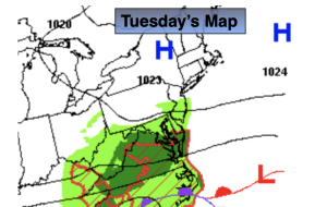
Tuesday will be a typical late August day as high pressure dominates. Mainly sunny skies are anticipated with just above average highs. The average high is in the lower 80s.

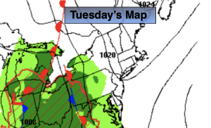
A hot push of air will arrive on Wednesday. Readings will get into the 90s and humidity levels will be high. The heat index will approach 100-105º along the urban corridor. A few storms will develop later in the day and evening as a cool front approaches. This front will be a season changer on Thursday and Friday. High pressure from Canada will bring down much cooler and drier air!

The beginning of the Labor Day Weekend has a few concerns. Saturday will feature an approaching cool front. It looks like the clouds may win the battle with sun. Scattered showers and storms are possible mainly for the second half of the day. Conditions will improve dramatically for Sunday and Labor Day!

Stay tuned.

Keep it here for a no nonsense, no hype forecast.

Tuesday:

Mostly sunny. Highs in the mid 80s. Northeast to Southeast winds at 5-10mph.

Tonight:

Mostly clear. Lows around 70º in the City, the 60s inland. Southwest winds at 5mph.

Wednesday:

Hazy, hot and humid. Scattered late day and evening storms. Highs in the mid 90s. Heat index 100º-105º in spots.

Thursday:

Partly sunny. Much cooler. Highs in the mid to upper 70s.

Friday:

Mostly sunny. Pleasant. Highs in the mid 70s.

Saturday:

More clouds than sun. Scattered afternoon and evening showers and storms. Highs around 80º.

Bright, Warm Monday. Spotty PM Storms…

Synopsis:

Today will feature plenty of sun and warm readings. An upper level low over New England will spark a few scattered showers and storms during the afternoon and evening. Any of these scattered storms could produce gusty winds, hail and torrential rain. The greatest threat will be North and East of the City.

Tuesday will be a typical late August day as high pressure dominates. Mainly sunny skies are anticipated with just above average highs. The average high is in the lower 80s.

A hot push of air will arrive on Wednesday. Readings will get into the 90s and humidity levels will be high. The heat index will approach 100º along the urban corridor. A few storms will develop later in the day and evening as a cool front approaches. This front will be a season changer on Thursday and Friday. High pressure from Canada will bring down much cooler and drier air!

Stay tuned.

Keep it here for a no nonsense, no hype forecast.

Monday:

Mostly sunny. Chance of afternoon scattered showers and storms. Highs in the mid 80s. Northwest to South winds at 5-10mph.

Tonight:

An evening spotty storm, otherwise mostly clear with patchy fog. Lows around 70º in the City, the 50s inland. Southeast to Northeast winds less than 5mph.

Tuesday:

Mostly sunny. Highs in the mid 80s.

Wednesday:

Hazy, hot and humid. Scattered late day and evening storms. Highs in the lower to mid 90s. Heat index near 100º in spots.

Thursday:

Partly sunny. Much cooler. Highs in the mid to upper 70s.

Friday:

Mostly sunny. Pleasant. Highs in the mid 70s.

Fine Friday. Spectacular Weekend…

Synopsis:

High pressure will build over the Eastern states. This will result is some fine August conditions right through the weekend. It’ll be sunny with moderating temperatures. Humidity levels will be low.

On Monday, an upper level low over New England will spark a few scattered showers and storms during the afternoon. The majority of the day will be dry.

We’ll be back to mainly sunny conditions on Tuesday as the high regains control.

Stay tuned.

Keep it here for a no nonsense, no hype forecast.

Friday:

Sunny. Highs in the lower 80s. Northwest to Southwest winds at 5-10mph.

Tonight:

Clear and comfortable. Lows in the mid 60s in the City, the 50s inland. Southwest to West winds less than 5mph.

Saturday:

Sunny. Highs in the lower to mid 80s.

Sunday:

Sunny. Highs in the mid 80s.

Monday:

Partly sunny. Chance of afternoon scattered showers and storms. Highs in the lower to mid 80s.

Tuesday:

Partly sunny. Highs in the mid 80s.

Fall Feel Continues…

Synopsis:

A cool pool of air from Canada has given our region a fall feel. Temperatures today will be about ten degrees below average. The average high is in the lower 80s. A mix of sun and clouds is expected.

We’ll experience a nice stretch the next several days as strong high pressure moves in from the West. It’ll be mainly sunny with moderating temperatures. Enjoy.

Stay tuned.

Keep it here for a no nonsense, no hype forecast.

Wednesday:

Mostly sunny. Highs in the lower 70s. Northwest winds at 10-15mph.

Tonight:

Mostly clear and quite cool. Lows in the upper 50s the City, the 40s & 50s inland. Northwest winds at 5-10mph.

Thursday:

Mostly sunny. Highs in the mid 70s.

Friday:

Sunny. Highs in the lower 80s.

Saturday:

Sunny. Highs in the lower to mid 80s.

Sunday:

Mostly sunny. Highs in the lower to mid 80s.

Clouds & Sun. Spotty PM Storm…

Synopsis:

A front will be slow to move off the coast today. A mix of sun and clouds is expected. Scattered showers and storms are possible later in the day. The majority of the day will be rain-free.

A cool pool of air will make a visit from Canada midweek. Tuesday and Wednesday temperatures will be in the 70s, well below the average high of the lower to mid 80s. A mix of sun and clouds is expected.

A couple of gems are expected for Thursday and Friday as strong high pressure moves in from the West.

Stay tuned.

Keep it here for a no nonsense, no hype forecast.

Monday:

Sun and clouds. Late afternoon showers and storms are possible. Highs in the lower 80s. West to Northwest winds at 8-12mph.

Tonight:

Partly cloudy and becoming much less humid. Cooler than recent nights. Lows in the lower 60s the City, the 50s inland. Northwest winds at 8-15mph.

Tuesday:

Partly sunny. Refreshing. Highs in the mid 70s.

Wednesday:

Mostly sunny. Highs in the mid 70s.

Thursday:

Mostly sunny. Highs in the upper 70s.

Friday:

Sunny. Highs in the lower 80s.

Humid. Sct’d Showers/Storms. Locally Heavy Rain…

Synopsis:

A slow moving area of low pressure and cool front will approach the region today. Humid air will be in place. Scattered showers and storms are possible just about anytime. There will be prolonged periods of dry times. Locally heavy rain is possible. A Flood Watch is up for NJ, Rockland and Westchester counties through tonight. Locally one to three inches of rain is possible. Flooding of streets, highways, streams and creeks are possible. If you encounter a flooded roadway, TURN AROUND, DON’T DROWN.

Any of the storms maybe strong to severe later today, especially over NJ. Keep an eye for threatening weather conditions.

On Monday the front will be slow to move off the coast. A mix of sun and clouds is expected. Scattered showers and storms are possible later in the day.

A cool pool of air will make a visit from Canada midweek. Tuesday and Wednesday temperatures will be in the 70s, well below the average high of the lower to mid 80s. A mix of sun and clouds is expected. The mercury will reach the 80º mark by Thursday.

Stay tuned.

Keep it here for a no nonsense, no hype forecast.

Sunday:

Mostly cloudy. Humid. Scattered showers and storms. Highs in the upper 70s. Southeast winds at 8-15mph.

Tonight:

Scattered showers and storms. Humid. Lows in the lower 70s the City, the 60s inland. Southeast winds at 5mph.

Monday:

Sun and clouds. Late afternoon showers and storms are possible. Highs in the lower 80s.

Tuesday:

Partly sunny. Cooler. Highs in the mid 70s.

Wednesday:

Partly sunny. Highs in the mid to upper 70s.

Thursday:

Partly sunny. Highs around 80º.