Synopsis:
An all time high for the month of February occurred today. The temperature at Central Park reached 78º breaking the monthly record high of 75 º set in 1930. The daily record was also broken. Today’s high of 78º shattered the the previous record for the day which was 68º set back. Simply amazing. Some coastal did not bask in the June heat because of a colder sea breeze.
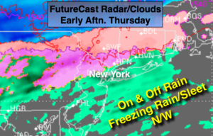
A dramatic change is on the way for tomorrow. A cold front will move through by morning. At the same time cold high pressure will move into New England as a wave of low pressure moves into the area. The result will be on and off rain. It just maybe cold enough well North and West for some freezing rain or sleet at times (map above).
Unsettled times will continue right into the weekend as several areas of low pressure ride along the jet stream. It won’t be raining all the time, but the grey skies will win out.
Stay tuned
Tonight:
Mostly cloudy with scattered showers. Lows in the lower 40s in the City, the upper 30s inland. Southwest to Northeast winds at 5-10mph.
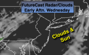
Thursday:
Cloudy with scattered showers. Much cooler. Highs remaining around 40º, the 30s inland. Freezing rain or some sleet may occur well inland with readings closer to freezing. Northeast winds at 8-12mph.
Friday:
Cloudy with on and off rain. Some freezing rain or sleet at times inland. Highs in the lower 40s, the 30s inland.
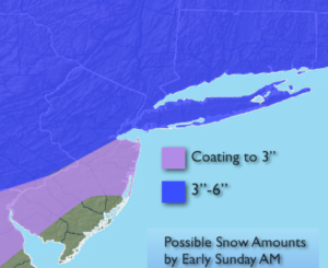
Saturday:
Mostly cloudy with spotty showers. Highs in the mid 50s.
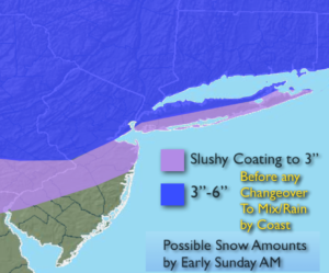
Sunday:
A steady rain likely for a majority of the time. Late day sun is possible. Highs in the mid 50s.
Monday:
It’ll finally dry out. Partly sunny skies are anticipated with highs in the lower 50s.
Keep it here for a no nonsense, no hype forecast.