Synopsis:
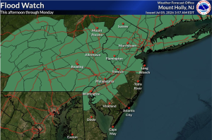
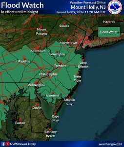
Areas of torrential rain will occur mostly over central and Southern NJ into this evening. Flash flooding has been reported. A Flood Watch is up for central and Southern NJ through this evening. If you encounter a flooded roadway, TURN AROUND-DON’T DROWN. The rain will taper off later this evening. Areas to the North will see little in the way of rain.
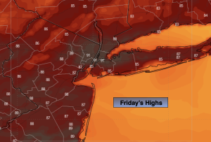
On Friday we’ll see mainly sunny skies. It’ll be very warm and humid. A spot storm is possible later in the day or evening as a cool front approaches.
The weekend will be a gem as high pressure influences our weather from Southeastern Canada. Sun and clouds is expected for Saturday. Sunday will feature wall to wall sunshine. Humidity will be low and temperatures will be pleasant.
No major changes are in store for Monday. The heat will return for Tuesday. Grab the sunglass and sunscreen. Enjoy!
Stay tuned.
Keep it here for a no nonsense, no hype forecast…
Tonight:
Areas of torrential rain for Central and Southern areas. Mainly dry to the North. Becoming partly cloudy. Muggy. Lows in the lower 70s in the City, the upper 60s inland. Light Southwest wind.
Friday:
Mostly sunny. Hot. Spot late day storm, Highs around 90º. West winds at 5-10mph.
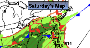
Saturday:
Partly sunny. Highs in the mid 80s.
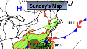
Sunday:
Sunny. Highs in the mid 80s.
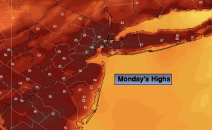
Monday:
Sunny. Highs in the mid 80s.
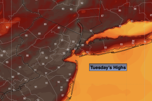
Tuesday:
Sunny. Hot. Highs around 90º.