Synopsis:
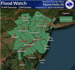
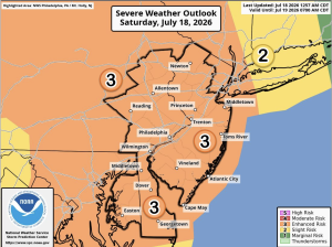
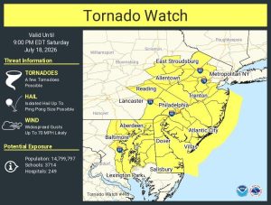
***Tornado Watch for much of NJ until 9PM. The atmosphere will become volatile later today. A warm front will lift North into the region at the same time energy aloft will swing overhead. This will result in scattered showers and storms. The exact timing is difficult but it looks like the greatest threat will be later this afternoon and evening. Most of the area is in a level 3 threat for severe thunderstorms. Damaging winds, hail and isolated tornadoes are possible. If a tornado warning is issued take it seriously and have a plan in place. Please keep an eye to the sky for threatening weather- be weather aware. When thunder roars go indoors. If you hear thunder you are close enough to be struck by lighting. A Flood Watch is also up through early tonight. Torrential rain in a short period of time may cause street and highway flooding. Never drive through a flooded roadway, you don’t know how deep that water is. Turn around-don’t drown.
The cool front will move off the coast toward midnight ending the threat of severe weather. .
Sunday will be the better half of the weekend. Partly sunny skies and seasonal temperatures are expected.
The week will start off bright and warm as high pressure moves overhead.
A warm front will move toward the area on Tuesday. A mix of sun and clouds is expected with the chance of afternoon storms.
A leftover shower is possible Wednesday, otherwise, skies will become partly sunny.
Stay tuned.
Keep it here for a no nonsense, no hype forecast…
Saturday:
Mostly cloudy. Humid. Chance of showers and storms. Locally heavy rain. Highs in the lower 80s. South winds at 10-20mph with gusts to 25mph.
Tonight:
Showers and storms early. Becoming partly cloudy. Lows around 70º in the City, the 60s inland. Southwest to West winds at 10-20mph.
Sunday:
Mostly sunny. Highs in the lower to mid 80s.
Monday:
Sunny. Highs in the lower to mid 80s.
Tuesday:
Partly sunny. Chance of afternoon storms. Highs in the lower 80s.
Wednesday:
Chance of a morning shower, otherwise, partly sunny. Highs in the lower 80s.