Synopsis:
First, I’d like to start off saying-“I’m just the messenger”. A stationary front will be over Southern NJ today and remain to our South this entire Mother’s Day Weekend. This will result in damp and cool conditions through Sunday.
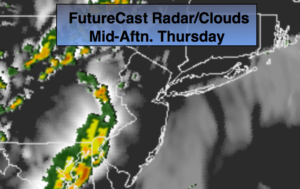
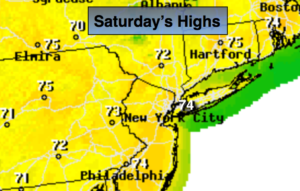
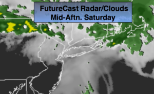
Today will be mainly cloudy with two round of showers. The first round will be this morning. Skies may brighten for a time over Central and Southern NJ but the wind will be off the colder Atlantic and that will keep the temperatures in the very cool 50s and lower 60s. Southern areas may pop into the 70s if the sun does sunshine for a time. The second round of showers and thunderstorms will move in toward dinner time and overnight. An upper level disturbance will energize the atmosphere and cause some of the storms be strong to severe over central & Southern NJ. This also will be where the best instability is due to the warm temperatures.
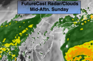
Mother’s Day will be damp, grey and cool. Clouds will hang tough with on and off showers and drizzle.
The stationary front will continue to influence our weather into the week. There will be times of showers and storms. It will not be a washout. Temperatures will warm as the flow becomes more Southerly by midweek.
Stay tuned.
Today:
Morning showers. There will be a break in the rain later this morning into the afternoon. The clouds maybe stubborn to burn off for most but a bit of sun is possible over Southern areas. Another round of showers and storm will develop later today and into tonight. Some of the storms maybe severe over Southern areas. Highs in the 50s & 60s in the NYC vicinity to the 70s over parts of Central and Southern NJ. Northeast winds at 5-10mph.
Tonight:
Scattered thunderstorms this evening, otherwise, scattered showers overnight. Lows in the mid to upper 40s throughout. Northeast winds at 5-10mph.
Mother’s Day:
Cloudy with on and off showers and drizzle. Highs in the upper 50s to lower 60s
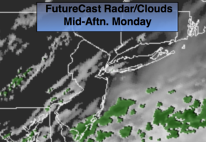
Monday:
Morning showers, otherwise, mostly cloudy. Highs around 70º.
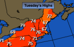
Tuesday:
Mostly cloudy. Scattered showers and storms. Highs in the mid 70s.
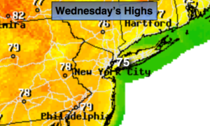
Wednesday:
Mostly cloudy. Scattered showers and storms. Highs in the mid 70s.
Keep it here for a no nonsense, no hype forecast.