Synopsis:
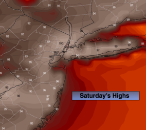
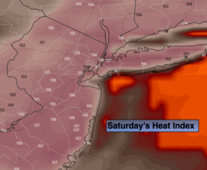
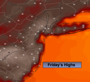
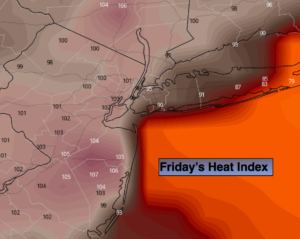
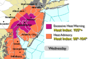
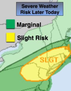
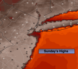
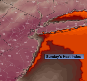
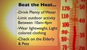
An Excessive Heat Warning is in effect for the entire tri-state area today as a heatwave continues to grip the area. The heat will peak today. A bubble of the hottest air will work around the Bermuda High this afternoon. The combination of high temperatures and humidity will result in a heat index of 100º-115º. Actual temperatures will flirt with 100º in many areas today. The humidity will be high. Please use the above suggestions to “beat the heat”.
The record high for today is 104º set in 1977. This will stand for at least another year.
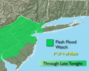
The heatwave should break Monday as a cool front works into the region with scattered showers and storms. Some of the rain will be torrential, especially Monday Night. A Flash Flood Watch has been posted for most of the tri-state area for later Monday and Monday night.
The front will linger in the morning on Tuesday with showers and storms, but the sun should return by afternoon. True relief from the heat and humidity will arrive.
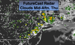
Wednesday and Thursday will be beauties with plenty of sunshine and low humidity.
Stay tuned.
Keep it here for a no nonsense, no hype forecast.
Today:
Hazy, hot and humid. Highs 95º-100º. Heat index 100º to 115º. West winds at 8-15mph.
Tonight:
Hazy, warm and muggy. Lows in the mid to upper 70s in urban areas, the upper 60s to 70s elsewhere. Winds becoming North at 5mph.
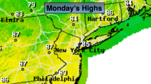
Monday:
Clouds & sun, not as hot but still humid. Scattered showers and storms. Highs in the lower to mid 80s.
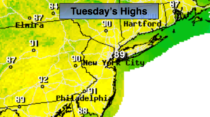
Tuesday:
Early showers and storms giving way to partly sunny skies, much less humid. Highs in the upper 70s..
Wednesday:
Mostly sunny and comfortable. Highs in the lower to mid 80s.
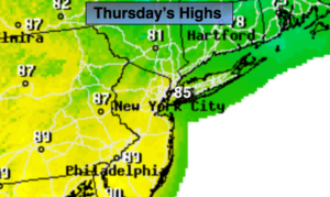
Thursday:
Mostly sunny. Low humidity. Highs in the mid 80s.