Synopsis:
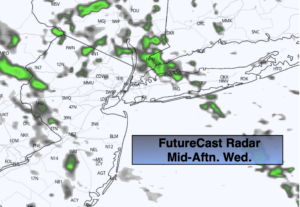
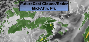
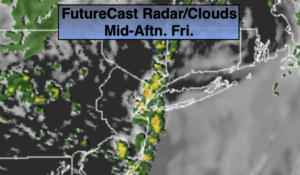
Welcome to May! The weather hasn’t changed much even though the calendar has. There will be areas of drizzle and showers this morning as storm that gave us last nights heavy rain moves into Eastern New England. If we’re lucky some areas may experience a bit of sun. Scattered showers and thunderstorms are possible during the afternoon as upper level energy with the departing storm moves through. Many areas will remain dry.
We’ll begin to dry things out tonight. Early showers will give way to partly cloudy skies.
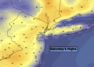
Our first weekend of May will be delightful as high pressure influences our weather over the Southeast. Saturday will be mainly sunny with highs several degrees above the average high of 66º. A mix of clouds and sun is expected for Sunday. Definitely a weekend to get outdoors!
The beginning of the week looks bright with seasonal temperatures.
Stay Tuned.
Keep it here for a no nonsense, no hype forecast.
Today:
Mostly cloudy. Areas of drizzle and light rain this morning. Spotty showers and storms this afternoon. There will be dry times. Highs in the mid 60s. Northeast to Northwest winds at 5-10mph.
Tonight:
Scattered evening showers, otherwise becoming partly cloudy. Lows in the lower 50s in the City, the mid to upper 40s inland. Northwest winds at 10-15mph.
Saturday:
Mostly sunny. Warm. Highs in the lower 70s.
Sunday:
Clouds and sun. Highs around 70º.
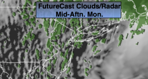
Monday:
Partly sunny. Highs in the upper 60s.
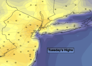
Tuesday:
Partly sunny. Highs in the mid 60s.