Synopsis:
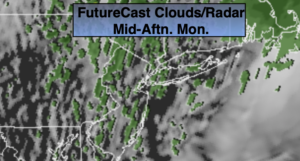
It will be a raw, chilly day as on and off showers are expected with backside of the low off the New England coast affecting the region. Readings will be some fifteen to eighteen degrees below the average high of 65º-feeling more like mid March.
The spotty showers will taper off this evening. Skies will become partly cloudy.
Tuesday will be the best day of the next five. It will be sunny and seasonal as high pressure settles over the East coast.
Clouds will dominate on Wednesday. Drizzle is possible during the afternoon with a flow off the ocean.
More rain is in the forecast for Thursday as another low moves in from the West.
Slow improvement will occur on Friday-May 1st as the low moves off the Northeast coast. The sun may shine from time to time but showers are still in the forecast.
The first weekend of May looks more promising in terms of sun and milder readings.
Stay Tuned.
Keep it here for a no nonsense, no hype forecast.
Today:
On and off showers. Highs in the 40s. North wind at 10-20mph.
Tonight:
Evening spotty showers, otherwise becoming partly cloudy. Lows around 40º in the City, the mid to upper 30s inland. Northwest winds at 8-12mph.
Tuesday:
Mostly sunny. Highs in the mid 60s.
Wednesday:
Mostly cloudy. Chance of afternoon drizzle. Highs in the mid 50s.
Thursday:
Rain. Highs around 60º.
Friday:
Mostly cloudy with a chance of scattered showers. Highs in the lower 60s.