Synopsis:
A storm will stay far enough offshore to spare the region significant precipitation today. Areas of light rain will occur in the early morning along the coast, otherwise the sun will return as the storm pulls away. It’ll become breezy with seasonal readings.
Tonight will be brisk and cold with all readings dipping well below freezing.
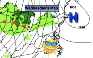
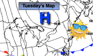
Canadian high pressure will dominate Thursday. Skies will be bright, but it’ll be chilly.
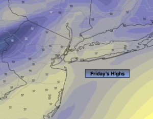
It looks like we’ll have to wait another year for the possibility of a white Christmas. Christmas Eve will feature sunny skies with readings above average. Christmas Day looks mild with a chance of a shower.
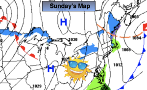
A spot shower is possible Sunday morning, otherwise the sun will rule the sky.
Stay tuned..
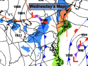
Wednesday:
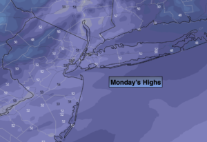
Morning clouds and areas of light rain at the coast will give way to mostly sunny skies. It’ll become breezy. Highs in the mid 40s. Northwest winds at 15-25mph with gusts to 35mph.
Tonight:
Clear, breezy and cold. Lows in the upper 20s along the coast, the teens and 20s inland. Northwest winds at 15-25mph with gusts to 30mph, then winds will diminish to 8-12mph late.
Thursday:
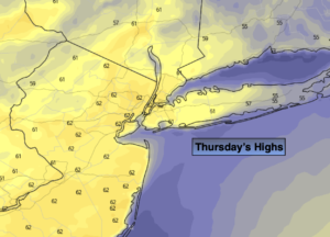
Sunny, colder. Highs in the upper 30s.
Christmas Eve:
Sunny. Highs in the mid 40s.
Christmas Day:
Mostly cloudy with scattered showers. Highs in the mid to upper 40s.
Sunday:
Morning showers possible, otherwise a mix of clouds and sun. Highs in the mid 40s.