Synopsis:
High pressure will dominate the Northeast through Thursday. The Spring feel will continue. Readings through Friday will be above the average high of 56º.
Morning clouds will give way to afternoon sun today as a weak disturbance moves to our North.
Bright skies and slightly cooler readings can be expected Thursday.
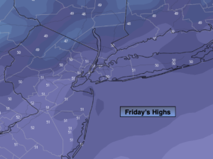
By Friday, a significant cold front will be approaching. Skies will be mostly cloudy. A period of rain and gusty winds is likely to develop during the morning hours and continue into the afternoon. It’ll be balmy, with temperatures well above average.
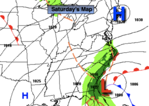
Saturday will feature a mix of sun and clouds. Readings will be more seasonal. Scattered showers are possible by late day and at night as upper level energy swings through.
Sunday will be a typical November day under a mix of sun and clouds.
Stay tuned.
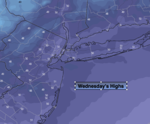
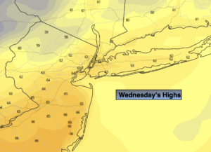
Wednesday:
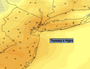
Clouds will give way to mainly sunny skies. Mild. Highs in the mid 60s. Northwest winds at 10-15mph.
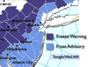
Tonight:
Clear. Cooler than recent nights. Lows in the mid to upper 40s in City, the 20s and 30s inland. North to Northeast winds less than 5mph.
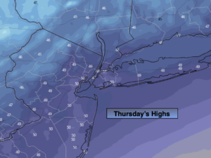
Thursday:
Mostly sunny. Cooler. Highs in the upper 50s.
Friday:
Mostly cloudy with a period of rain and gusty winds. Balmy. Highs in the lower to mid 60s.
Saturday:
Partly sunny, breezy and cooler. Chance of showers by late day. Highs in the mid to upper 5os.
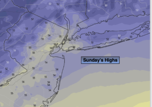
Sunday:
Partly sunny. Highs in the mid to upper 5os.