Synopsis:
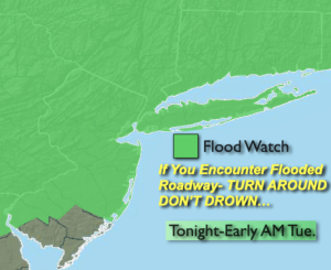
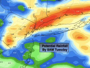
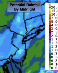
Low pressure and it’s associated fronts will be over the area through tonight. The heaviest rain is over. Any early AM showers will give way to clouds and some sun. The majority of the day looks dry. A weak front will be over the region. A few scattered evening and nighttime showers and storms are possible as the front moves to the coast.
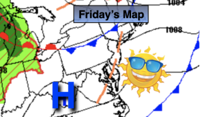
Weather systems will be weak Wednesday and Thursday. This will result in decent days with plenty of sun and seasonable readings. A weak cool front will approach Friday with a few more clouds but no rain is anticipated.
The weekend looks stellar with abundant sunshine and warm readings as high pressure builds over the region.
Stay tuned.
Keep it here for a no nonsense, no hype forecast.
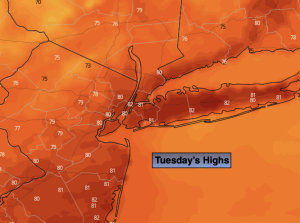
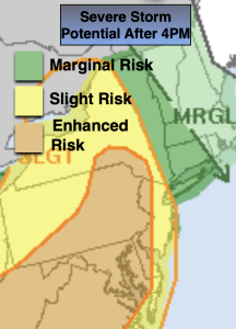
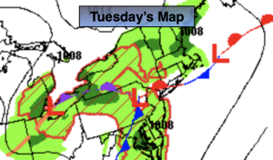
Tuesday:
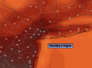
Scattered early morning showers, otherwise more clouds than sun. Humid. Chance of scattered evening showers and storms. Highs in the lower 80s. Northeast to North winds at 5-10mph.
Tonight:
Isolated showers and storms. Lows in the 60s throughout. Northeast winds at 5mph.
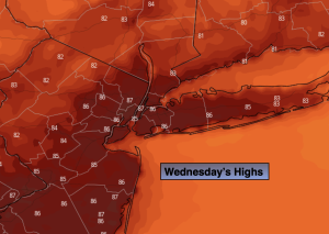
Wednesday:
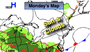
Mostly sunny. Highs in the lower to mid 80s.
Thursday:
Partly sunny. Highs in the lower to mid 80s.
Friday:
Partly sunny. Highs in the mid 80s.
Saturday:
Sunny. Highs in the mid 80s.