Synopsis:
Scattered showers will occur this morning as a weak cool front bumps into our humid airmass. The showers will be short-lived as the system moves rapidly offshore. The sun will return by midday and the afternoon will be mainly sunny and warm with lowering levels of humidity.
The end of the week looks delightful with bright, refreshing conditions as strong high pressure moves in. A delightful start to the month of September and the Labor Day Weekend. In fact the entire Labor Day Weekend will be sunny and warm with high pressure anchored over the Northeast. Enjoy!
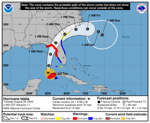
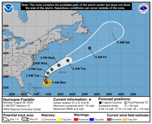
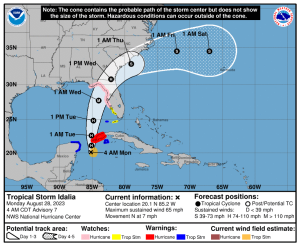
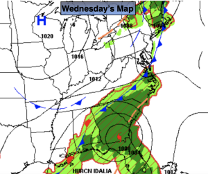
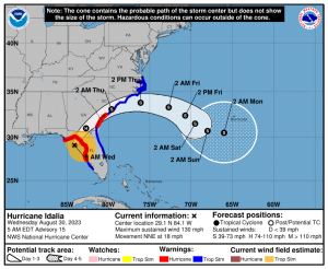
Hurricane Idalia has made landfall in big bend area of Florida as a major hurricane (tracking maps are above). The storm will move over Georgia and the Carolinas through Thursday. Our area will only experience rough surf and rip currents.
Stay tuned.
Keep it here for a no nonsense, no hype forecast.
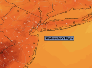
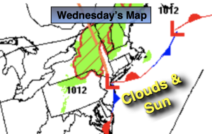
Wednesday:
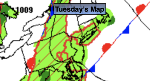
Scattered morning showers, humid. Afternoon sun with lowering humidity. Warm. Highs in the lower to mid 80s. Winds becoming Northwest at 8-12mph.
Tonight:
Partly cloudy. Less Humid. Lows in the mid 60s along the coast the 50s inland. Northwest winds at 10-15mph.
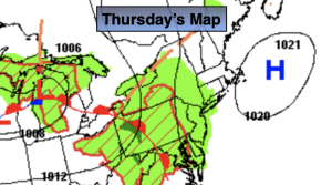
Thursday:
Mostly sunny, cooler. Much less humid. Highs in the upper 70s.
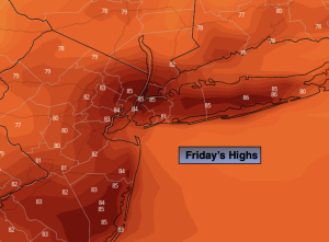
Friday:
Sunny. Highs in the upper 70s.
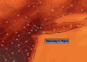
Saturday:
Sunny. Highs around 80º.
Sunday:
Sunny. Warmer. Highs in the mid 80s.