Synopsis:
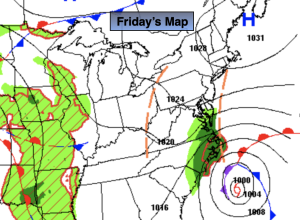
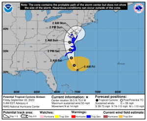
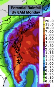
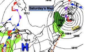
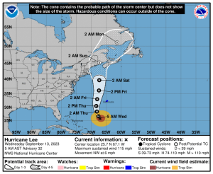
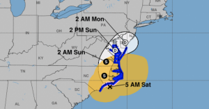
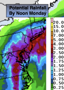
It’ll be a wet start to our new season of Fall. Autumn arrived today at 2:50AM EDT. Weakening Tropical Storm Ophelia made landfall at 6:20am today along North Carolina coast. On and off rain is expected today from this system. Gusty winds are expected as the pressure gradient tightens between the low to the South and high pressure over the Atlantic. Winds could gust in excess of 50mph along the NJ coast, 40mph wind gusts are likely elsewhere. The brunt of this first part of the storm will be midday into the afternoon on Saturday. Bands of heavy rain will move through. This low will be stubborn to exit resulting in the threat of on and off rain for Sunday into Monday. This will be the actual circulation of the storm’s remnants moving through-part two of the event. Winds will have diminished some. The potential for one to three inches of rain exists for the 48 hour period. Flash flooding is possible.
By Tuesday, the system will finally have moved off the coast and high pressure will nose in from the North. A mix of sun and clouds is expected with cool readings. Similar conditions are expected for Wednesday.
Stay tuned.
Keep it here for a no nonsense, no hype forecast.
Saturday:
On and off rain. Possibly heavy at times. Windy, especially at the coast. Highs in the lower 60s. Northeast winds 15-25mph with gusts between 40-50mph.
Tonight:
On and off rain. Windy at the coast. Lows in the 50s throughout. Northeast winds at 10-20mph with gusts to 40mph at the coast.
Sunday:
On and off rain. Highs in the mid 60s.
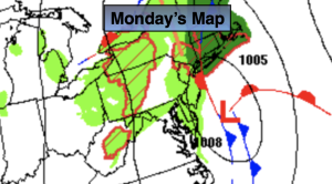
Monday:
Morning showers, remaining mostly cloudy during the afternoon. Highs in the mid 60s.
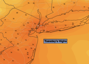
Tuesday:
Partly sunny. Highs in the mid 60s.
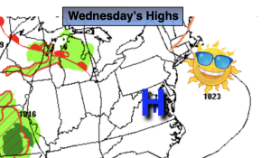
Wednesday:
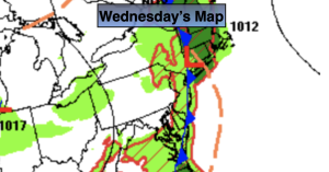
Mostly sunny. Highs in the mid 60s.