Synopsis:
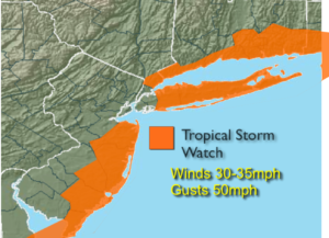
***Tropical Storm Watch for Suffolk County Long Island & Southeastern Connecticut .The Watch has been canceled for areas to the West and Coastal NJ***
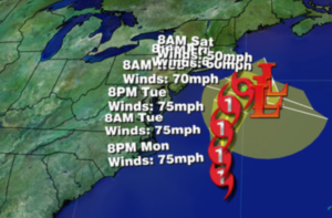
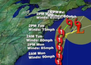
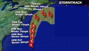
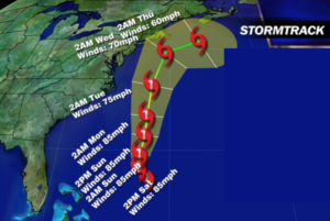
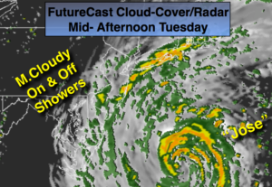
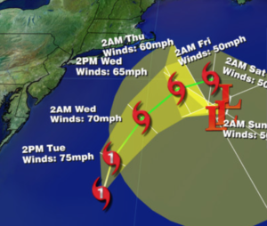
Hurricane Jose is well off the Eastern seaboard and moving North with winds of 75mph as of this writing. Most of the models are in agreement that the hurricane will ride North-parallel and up off the coast through Wednesday (NHC map above, second graphic). The potential of coastal showers and gusty winds are in the forecast for today and into Wednesday morning especially over Eastern Long Island, where a period of heavier rain is possible. The Tropical Storm Watch is now only in effect for Suffolk County Long Island & Southeastern Connecticut. Winds in this area may gust between 40-50mph. Minor coastal flooding is also a possibility at the time of high tide. High surf, rip currents and beach erosion is likely. As with any tropical system; I NEVER let my guard down until the storm is North of our latitude.
The sun should return later Wednesday and a nice stretch is on the way was as Summer turns to Fall on Friday. It will be warm.
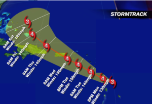
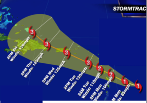
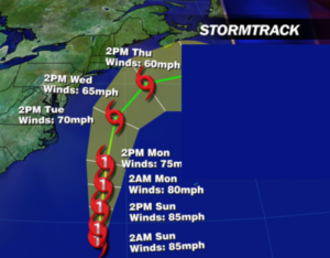
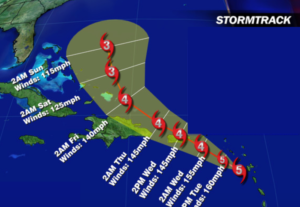
This is the peak of hurricane season. Hurricane Maria continues to strengthen and now is a potentially catastrophic Category 5 with winds of 160mph as of this writing. It hit the island of Dominica and is moving into the Caribbean. The Virgin Islands and Puerto Rico are next in line for Maria which could be a category 4 with winds of 150mph. (map below).
Stay Tuned.
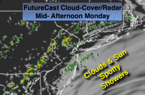
Today:
Mostly cloudy and becoming windy, especially at the coast. On and off showers are likely. Highs in the mid 70s. North wind increasing to 15-30mph with higher gusts at the coast.
Tonight:
Partly cloudy with scattered showers over Eastern sections. Lows in the upper 60s in the City, the lower 60s inland. North winds at 15-25mph.
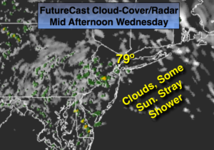
Wednesday:
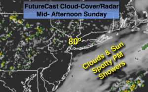
Scattered showers possible over Eastern Long Island in the morning, otherwise becoming partly sunny. Windy. Highs in the mid 70s to around 80º.
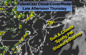
Thursday:
Partly sunny and warm. Highs around 80º.
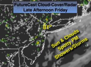
Friday:
Partly sunny and warm. Highs in the upper 70s.
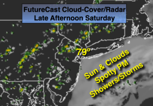
Saturday:
Sunny and warm. Highs around 80º.
Keep it here for a no nonsense, no hype forecast.