Synopsis:.
Our Spring preview is over as much colder air has moved in. It will be a shock to the body, to say the least, after many regions were in the 70s the last two days. Gusty winds will add a bite. Temperatures will actually be seasonal for this time of the year as high pressure dominates.
As we flip the calendar from February to March this week our temperatures will once again feel more like Spring than Winter.
Looking ahead, much colder temperatures are expected by Friday and Saturday. At this time it looks snowless.
Today:
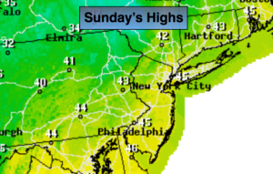
Partly sunny, breezy and colder with readings in the mid 40s. West to Northwest winds at 15-25mph. Wind chills will be in the 30s.
Tonight:
Mostly clear. Chilly. Lows in the mid 30s in the City, the 20s inland. West to Southwest wind at 5-10mph.
Monday:
Partly sunny. Highs in the lower 50s.
Tuesday:
Mostly cloudy and mild with scattered showers. Highs in the mid 50s.
Wednesday:
Mostly cloudy and mild with scattered showers. Highs near 60º.
Thursday:
Partly sunny and windy. Highs near 55º early in the day. Temperatures will drop during the afternoon.
Stay Tuned.
Keep it here for a no nonsense, no hype forecast.