Synopsis:
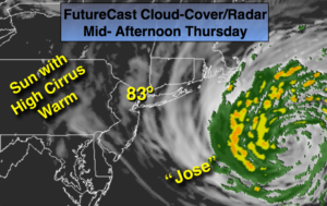
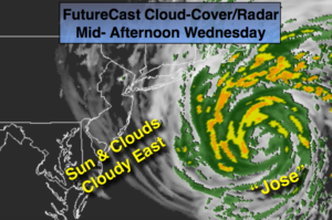
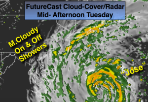
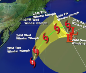
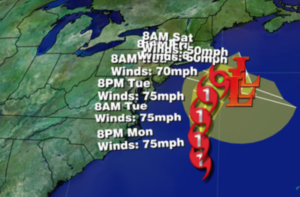
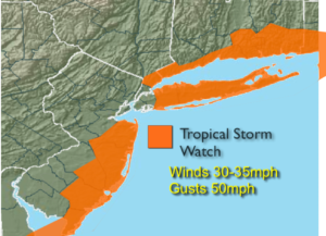
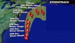
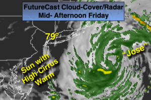
Tropical Storm Jose is well off the Eastern seaboard and meandering while slowly weakening. Winds are 50mph as of this writing. Rough surf and dangerous rip currents will continue. The humidity has finally decrease as Jose loses it’s influence on our region. We’ll be dealing with less of Jose clouds on Friday as the storm continues to weaken.
High pressure will build into the Northeast as Jose stays offshore. Warm days are expected as we turn the calendar page from Summer to Fall. In fact, it will be Summer-like right into the weekend and the beginning of next week. The Autumnal Equinox occurs at 4:02pm today. At this exact time, the Sun’s direct rays move South back over the Equator.
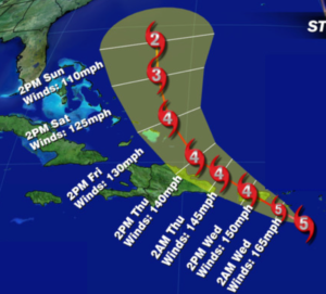
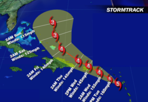
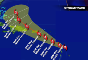
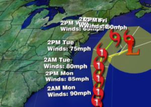
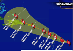
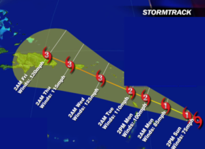
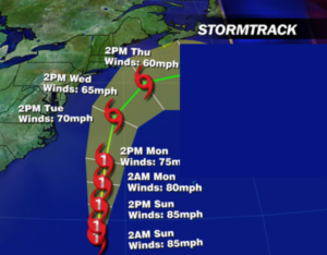
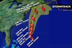
Hurricane Maria as of this writing has winds at 125mph-category 3 status. The hurricane will continue on it’s Northwest trek and is just East of the Southeastern Bahamas. The Turks and Caicos have been spared a direct hit. The latest computer guidance suggests Maria will move North this weekend through the open Atlantic. It looks more and more that the hurricane will stay off the East coast as it continues to move between Bermuda and the mainland. Fingers crossed.
Stay Tuned.

Today:
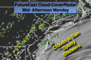
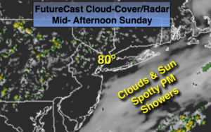
Mostly sunny (high clouds from time to time) and warm. Much less humid. Highs around 80º. North wind at 10-15mph with gusts to 20mph at the coast.
Tonight:
Clear to partly cloudy. Lows in the mid 60s in the City, the lower 50s inland. North winds at 8-12mph.
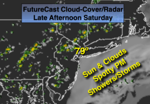
Saturday:
Mostly sunny and warm. Highs in the mid 80s.
Sunday:
Mostly sunny and warm. Highs in the mid 80s.
Monday:
Mostly sunny and warm. Highs in the mid 80s.
Tuesday:
Mostly sunny and warm. Highs in the mid 80s.
Keep it here for a no nonsense, no hype forecast.