Synopsis:
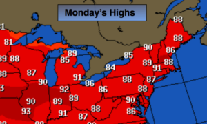
The heat will return for the beginning of the week as high pressure moves off the coast and a Southwest flow develops. Temperatures will not be as hot as last week and the humidity will only rise to moderate levels.
A cool front will move through Tuesday night. This is good news as another heatwave will not be in our near future. High pressure will move in once again for the rest of the week resulting in typical July readings and low humidity.
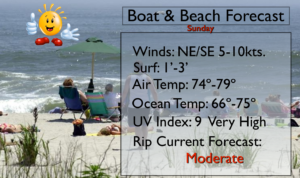
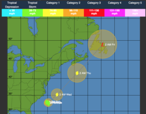
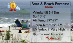
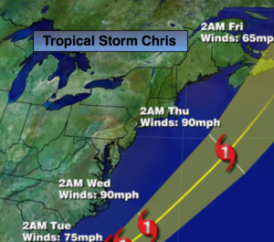
Tropical Storm Chris is off the North Carolina coast and is basically stationary. Chris will most likely become a hurricane in the next 24 hours. Warm waters and little shear will help to strengthen the storm. At this time, the system looks to stay off the coast and eventually move to the Northeast out to sea during the upcoming week. Rough surf and dangerous rip currents will be the main concern for our area during the upcoming week.
Stay tuned.
Today:
Sunny and warmer with highs in the mid to upper 80s. Southwest winds at 8-12mph.
Tonight:
Clear. Lows around 70º in the City, the 60s inland. South to Southwest winds under 5mph.
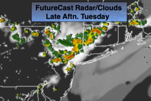
Tuesday:
Hazy, hot and humid. Highs around 90º.
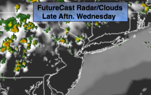
Wednesday:
Mostly sunny. Highs in the mid 80s.
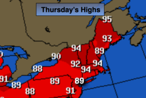
Thursday:
Sunny. Highs in the mid 80s.
Friday:
Sunny. Highs in the mid 80s.
Keep it here for a no nonsense, no hype forecast.